
Imagery Base Map
The Imagery Base Map is a combination of up-to-date aerial photographs and cartographic elements, providing a good overview of the current landscape in an appealing format.
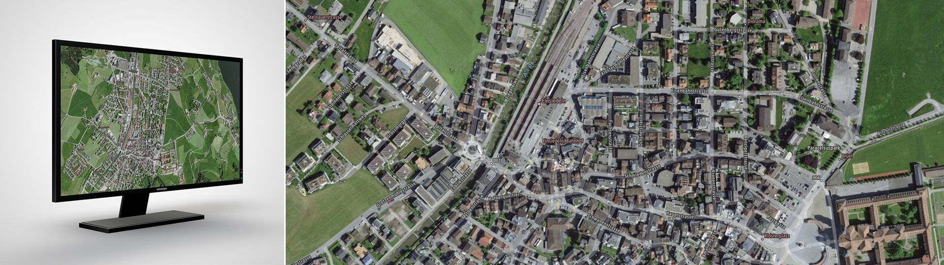
The Imagery Base Map presents a good overview of the current landscape thanks to a combination of orthoimages (rectified aerial images) and cartographic elements. The overlaid cartographic vector information on the orthophoto improves the orientation and interpretability of the content without making it harder to distinguish the visible information in the aerial photograph. Due to the applied technology of visualizing, the unchanged or individually adapted map integrates into your own website. The Imagery Base Map rests on official data: the topographic landscape model, the digital orthophoto mosaic (SWISSIMAGE), the digital cartographic models and the official road directory. The high-resolution orthophoto mosaic covers the whole of Switzerland and the bordering countries. Thanks to the additional data integration of OpenStreetMap for foreign countries and the "Web Mercator" global projection system, worldwide vector information is available.
Service Preview Mapbox "Vector Tiles"
Detailed information on the "Mapbox Vector Tiles" service, with which the web maps can be obtained, can be found at Vector Tiles Service.
Imagery Base Map in the service preview