
3D: Special visualizations and geodata from swisstopo
In addition to the official products, swisstopo offers the creation of individualised 3D visualisations and geodata as a service. Customer-specific results that are suitable for a defined area of interest can be created on request from various source data.

3D data packages
3D data packages combine various swisstopo data sets or products in one package. These packages are designed for the realisation of 3D visualisations. If possible, the data sets contained in them have the same format, the same coordinate system and the same structure. The combination of data sets in one package thus eliminates the need for conversions and transformations of different data and makes them much easier to use.

Buildings and terrain as IFC files
swisstopo offers building and terrain data in IFC format. Specialists now have access to optimized environment data for BIM projects (Building Information Modeling). These datasets are useful for visualizations in BIM viewers and for the combination with other BIM data.

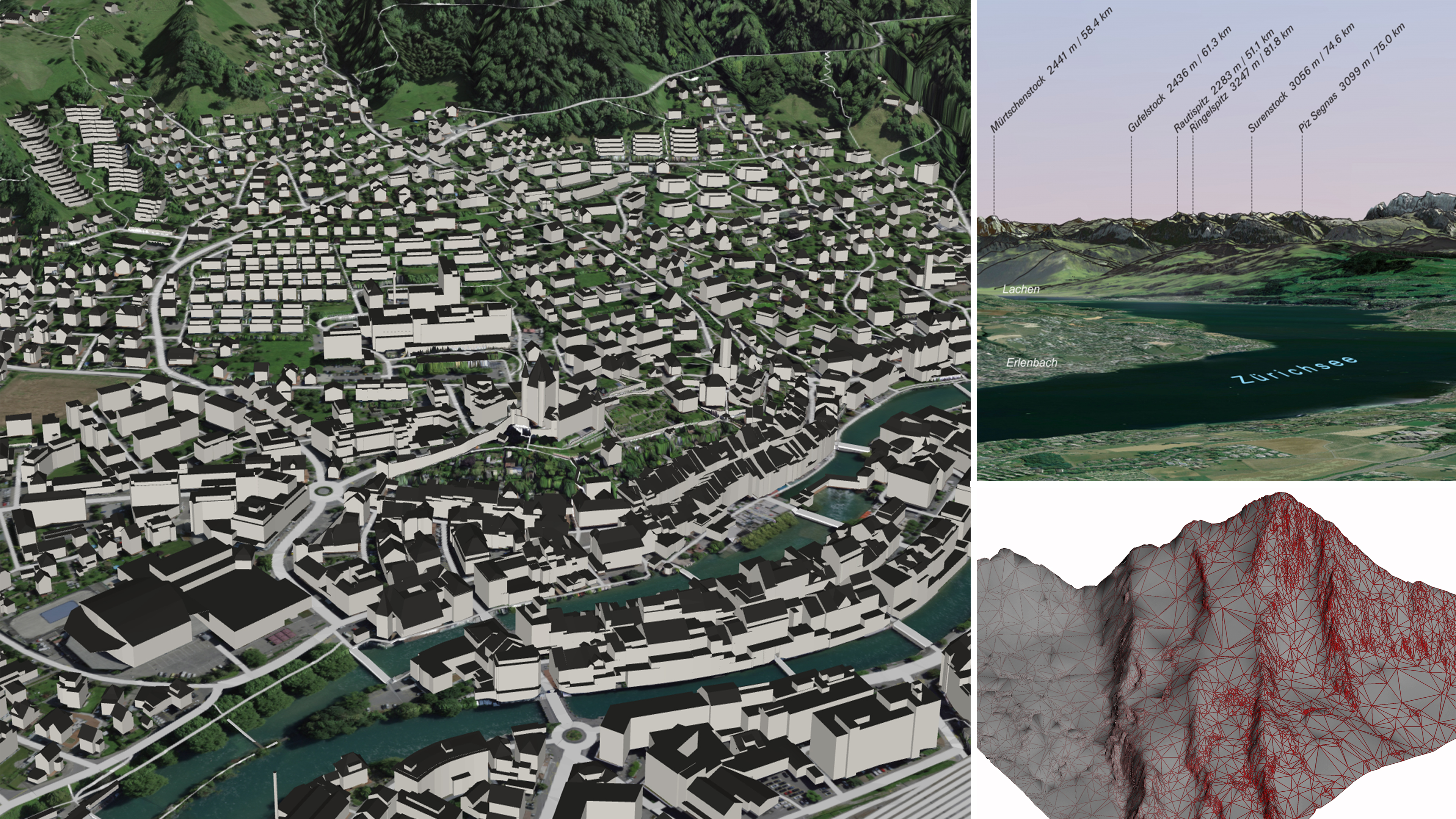
DIGIRAMA
Should you need to print a digital panorama with a realistic perspective on paper or on a metallic support, the DIGIRAMA (DIGItal panoRAMA) range of products is ideal for you. Depending on customers’ needs, various representations involving different levels of automation are possible. The range of specifications for these custom products allows for everything from a simple and cost effective solution for quick panoramic overviews to high quality solutions for panoramic plaques.

3D flights
With 3D flights, three-dimensional data can be viewed dynamically, by superimposing topographic models with satellite or aerial images, vector data or other geo-referenced data. The visualisation takes place along a flight line. Each 3D flight is produced individually according to customer requirements and can therefore meet a broad variety of criteria. 3D flights are an ideal way of presenting spatial projects in a dynamic, appealing and easy-to-understand way. Their use is suited for depicting infrastructure, ecological and other projects.

Other services
Our specialists derive further products from the swisstopo geodata. This enables us to cover both frequently requested and very specific customer needs.
The 3D geodata and visualisations listed here are customised at the request of the client. They are not included in our download offer and belong to the geodata that cannot be downloaded directly. For this reason, provision fees are charged when an order is placed. Further information can be found here: Conditions for Geodata. For additional information or orders, you can also contact geodata@swisstopo.ch.
Federal Office of Topography swisstopo
Seftigenstrasse 264
3084 Wabern