
Cableway or on foot – the right way into the mountains
Planning a mountain hike? Cable cars provide a comfortable way to gain altitude while saving your energy for the adventures ahead. Whether you prefer a relaxed walk on a hiking trail, a more demanding mountain trek, or—for the bold and well-equipped—an alpine hike or via ferrata, there’s something for everyone. Learn how to plan the perfect route for your needs.

There is a lot to discover in the mountains! In the video, Oli and Elisa explain how you can identify useful tools and possible requirements in the national maps before you are outside exploring.
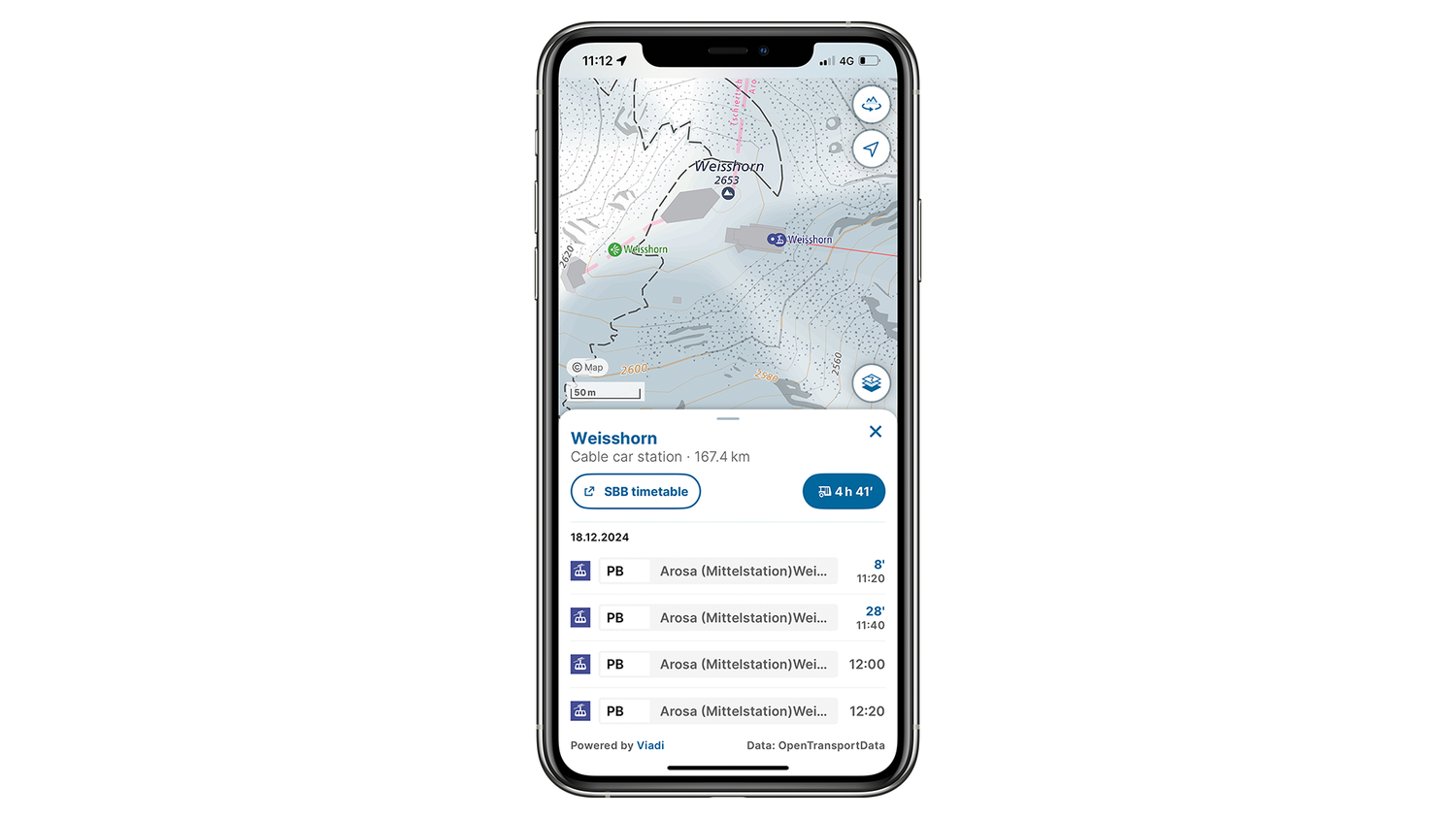
Cableways
You can comfortably reach the summit with an aerial cableway or a cable car. But how do you identify these lifts on a national map, and are they all available for public use? There are four main types of cableways:

Typically, two large cabins shuttle between the valley and the mountain. While one departs from the valley, the other descends from the summit; they meet midway and arrive at opposite terminals. These usually operate on fixed schedules.

Cable cars or chair lifts have multiple smaller cabins or seats that circulate continuously. At stations, cabins detach from the cable for easy boarding. No fixed schedule - you can hop on anytime.

These transport goods, for example supplies for mountain restaurants or alpine farms. Cabins are open and not designed for passengers.

Ski lifts, also known as drag lifts, operate continuously but use T-bars, disc bars, or handles instead of cabins. They’re only active in winter for skiing.
Pro tip: Check cable car operating hours and gondola departure times easily via the app - stay informed and keep everything at your fingertips.
Hiking trails
Prefer to conquer the summit on your own? Choose from trails with varying difficulty levels. Always check the trail categories and stick to routes matching your experience. Look for on-site signage to identify classifications.

Features wide paths with steps for steep sections, marked along the trail by yellow diamond-shaped signs.

Features well-marked but often steep, narrow, or exposed trails through rough terrain. Safety chains may be installed in challenging sections. These trails are marked by red-white-red signage on visible objects.
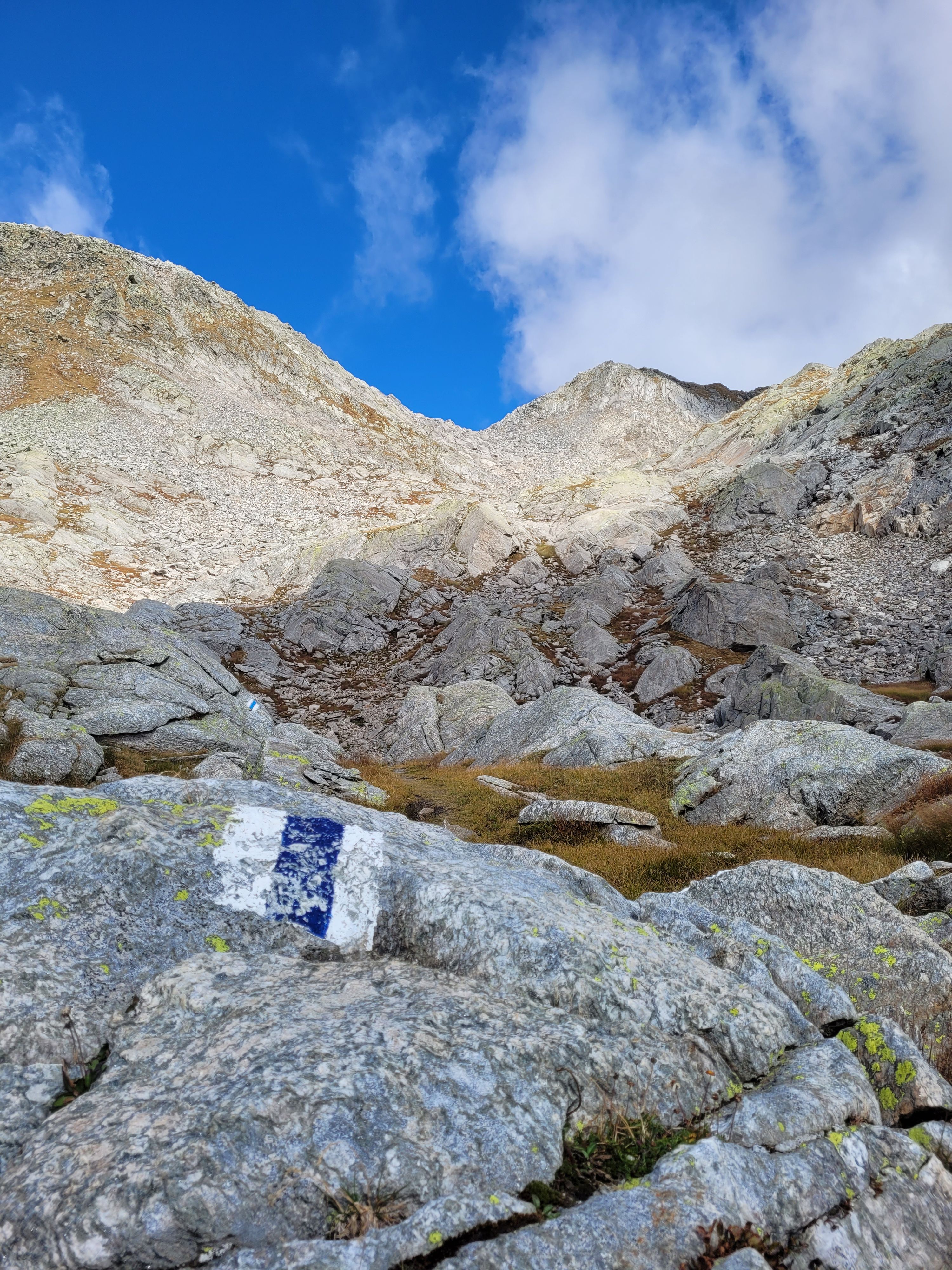
Blue-white-blue marked alpine trails include partly pathless sections, may include brief climbs, and may traverse scree, snowfields, or glaciers.

Via ferratas are protected climbing routes featuring steel cables, ladders and footholds, allowing you to tackle exposed sections safely with minimal gear. A via ferrata kit, including harness and carabiners, is essential for clipping into the safety system.

Golden rule: Only attempt trails if you have the right equipment.
If you would like to learn more about the different road and trail categories or want to find out a simple rule of thumb for calculating hiking time, you can find other interesting blog articles here: Map reading made easy (admin.ch)
Map reading is in!
Map reading is not only a useful skill for all outdoor enthusiasts but also helpful for planning. With a bit of practice and the right information, you can organise your trips even better and impress your friends with your expertise. Incidentally, our famous Swiss national maps are among the most detailed and accurate in the world. By the way: it doesn’t matter whether you use the swisstopo map on your smartphone or as a paper map, as the legend stays consistent.
Would you like to know more? Further information can be found in the legend (also called the “key”) for all swisstopo maps: Map reading | swisstopo Online Shop
Federal Office of Topography swisstopo
Seftigenstrasse 264
3084 Wabern