
FIND - Sinkholes
Mapping of sinkholes in Switzerland using automatic methods. Beneficiary administration: swisstopo.
Context
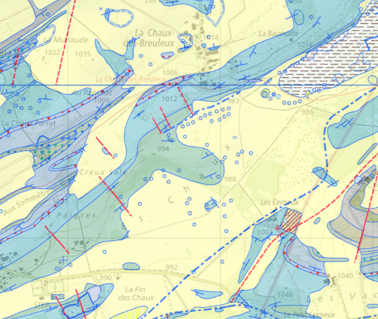
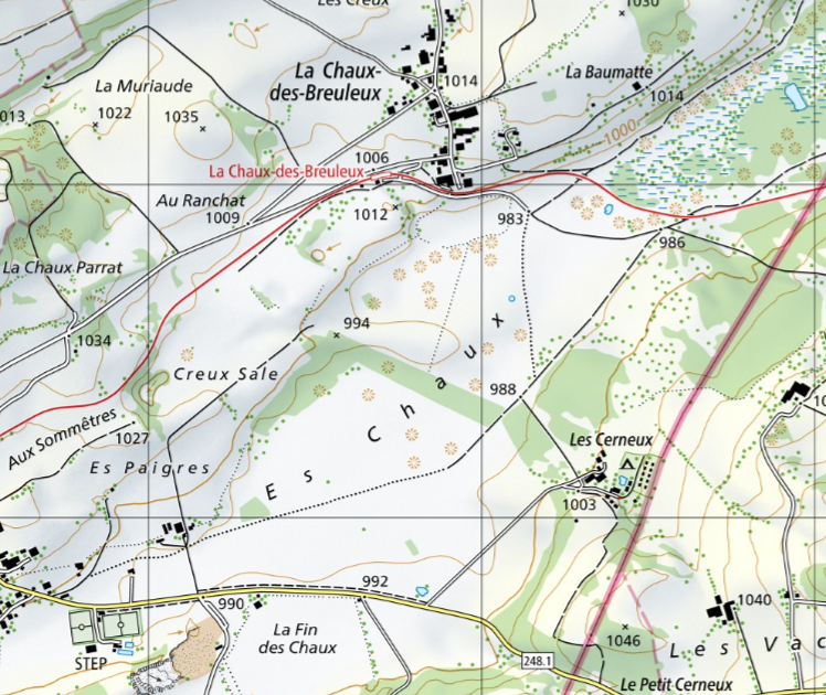
Sinkholes are cone-shaped depressions characteristic of karst environments. In Switzerland, they are mapped on national and geological maps by the Federal Office of Topography (swisstopo). These maps are based on the swissTLM3D and GeoCover products, respectively. Unfortunately, these inventories are very heterogeneous.
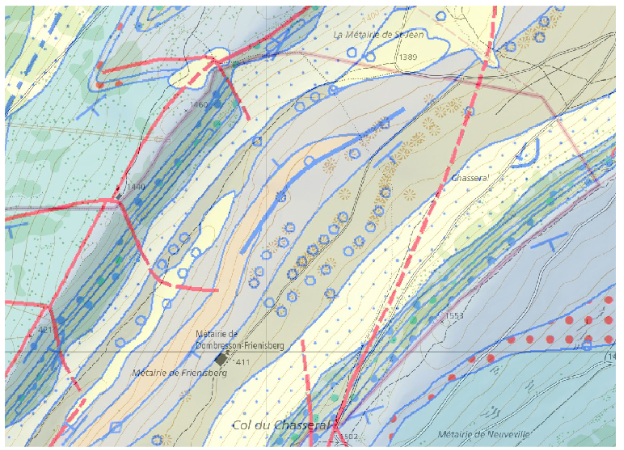
As there is no standard definition in Switzerland for characterizing sinkholes, their mapping is always subject to the assessment of the geologists and cartographers in charge. The introduction of an automatic detection method would speed up and standardize the mapping of sinkholes in Switzerland. It would enable sinkholes to be defined on the basis of clear criteria and limit the variability resulting from expert assessment when checking the results.

This project was carried out in collaboration with the National Geological Survey of swisstopo.
Method
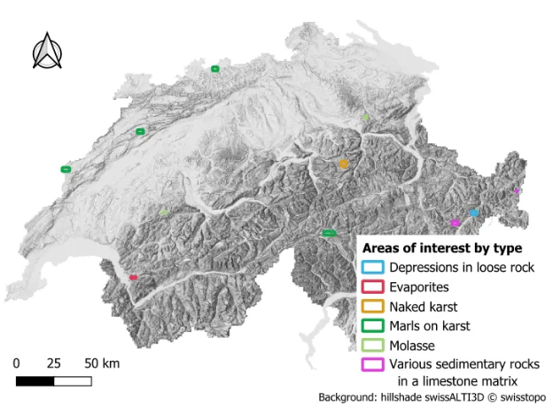
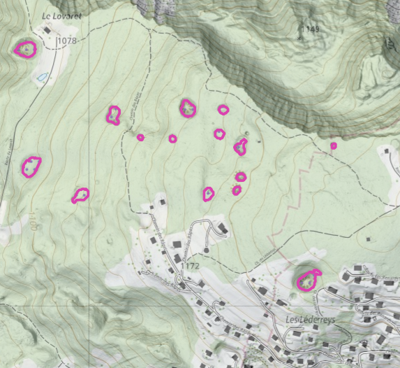
In this project, four methods were tested to automatically detect sinkholes on different lithological soils in Switzerland. Eleven areas of interest were defined on six different types of lithology. All methods are based on processing the swissALTI3D digital terrain model, and their parameters were optimized for each lithological type based on a ground truth established by the project's geological expert. This is considered accurate but not exhaustive.
.png?auto=format)
Results
The results were judged by the expert geologist to be satisfactory, although incomplete, for the areas of evaporites, depressions on loose rock, marl on karst in the Neuchâtel Jura, and molasse. However, they were insufficient and unusable for areas of bare karst, marl on karst in the Alps, and various sedimentary rocks on a limestone matrix. Even where the results were satisfactory, the expert stressed the importance of monitoring and correction work.
According to the metrics, the results are mediocre or even poor, with an F2 score ranging between 0.27 and 0.81 for the best method on each type of area. This is due to two limitations:
- The quality of the ground truth: A large number of sinkholes were not digitized during the ground truth capture, particularly among the smallest features. In addition, the distribution of digitized sinkholes in certain areas was very uneven and not representative of their actual distribution.
- Portability of methods: The methods drawn from scientific literature were not developed for the types of topography found in Switzerland. They had been tested and optimized for the karst plateaus of the French Jura or the Aggtelek Karst in Hungary. It is debatable whether these methods can be applied as effectively in Switzerland by adapting their parameters.
In conclusion, no satisfactory automation can be achieved until the ground truth is comprehensive and consistent. In this project, no clear definition of sinkholes that could be applied to digitization from aerial views was established, and no comprehensive ground truth could be produced. The first priority for improving the results would be to improve the ground truth. Next, the testing methods could be refined, but we noted that the methods tested here may not be suitable for Swiss geology. A new automatic method would then need to be developed or, more specifically, deep learning could be used. Deep learning on RGB imagery is unlikely to work well, but three bands based on DTM processing could be a good choice. For example, sky view factor, aperture, or local dominance could be used.
Documented resources
All STDL work is published under an open license, and we encourage you to use it in your projects.
Index
Back to the homepage of STDL
Swiss Territorial Data Lab
The Swiss Territorial Data Lab (STDL), launched in 2020 as part of the Swiss Strategy for Geoinformation (SGS), was part of Action Area 5, “Promoting innovation.” This lab offered public administrations a real testing ground where they could try out new approaches to meet their specific challenges. The STDL promoted collaboration between technical and business experts in order to co-create effective and tailored solutions.
Office fédéral de topographie swisstopo
Seftigenstrasse 264
3084 Wabern