
Geodetic Reference systems
A geodetic reference system defines a spatial coordinates system (origin and orientation of coordinate axes) for indicating spatial positions (location, height) and gravity of points. This definition also specifies the shape, size and spatial location of the reference area (usually a rotation ellipsoid), plus (where applicable) the corresponding physical parameters of the earth’s gravity field and a map projection.
Geodetic reference systems are used for defining the applicable coordinate axes, their spatial location and the applicable reference. They also define the map projection to be used. In Switzerland, various global and national reference systems are in use.
Global terrestrial reference systems
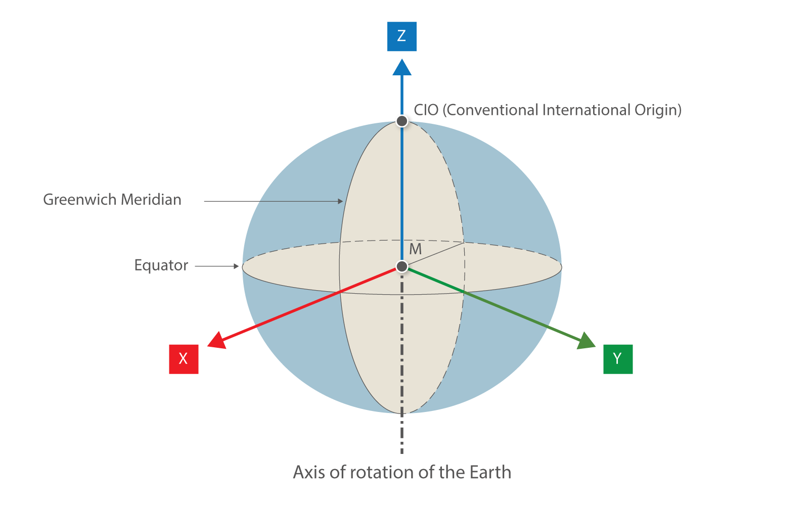
Global terrestrial reference systems are geocentric Cartesian coordinate systems with their origin in the earth's centre of gravity M. A «Conventional Terrestrial System» (CTS) has its point of origin at M, with its Z axis passing through the north pole (Conventional International Origin: CIO), its XZ plane passing through the mean zero point in Greenwich, and its Y axis completing the definition of a right-handed coordinate system.
Local reference systems
Local reference systems are national coordinate and height systems which are used for official national and cadastral surveying. They include the local reference ellipsoids and map projections with their specific national coordinate systems.
Federal Office of Topography swisstopo
Seftigenstrasse 264
3084 Wabern