
Hidden details in maps: lake depths
If you take a close look at Switzerland’s topographic maps, you will discover some exciting details – even beneath the water’s surface. The blue contour lines in lakes tell stories of hidden depths and sometimes of human interaction with nature too.
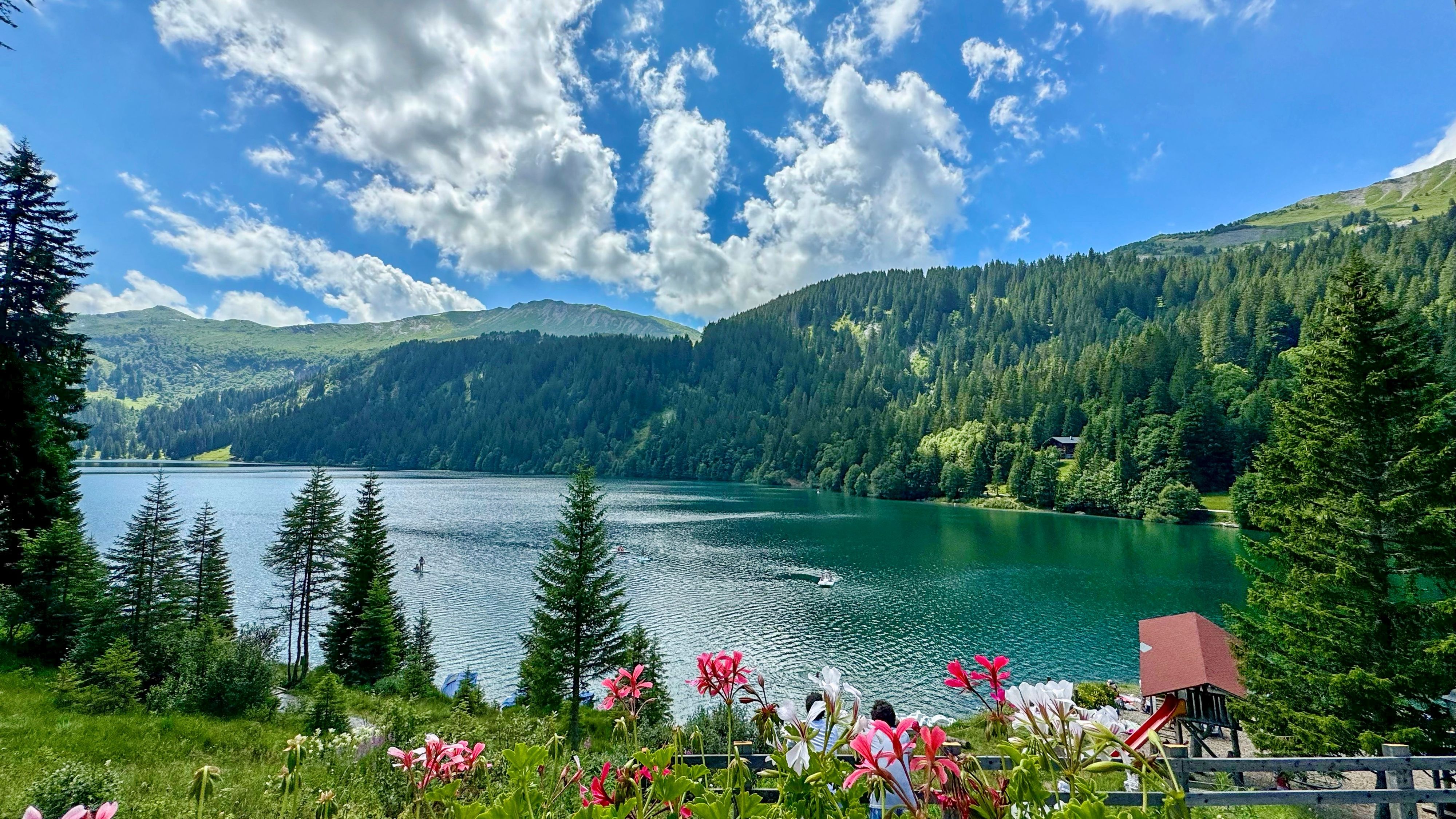
Imagine a bright blue sky, lush green forests, and a crystal-clear mountain lake just waiting to be discovered. A perfect day for hiking! Let’s take a trip to beautiful Lake Arnen – and learn how to get the most out of your map, uncovering its hidden details along the way.
Watch the video by Elisa and Oliver and learn about important signs while hiking around the lake.
Lake level
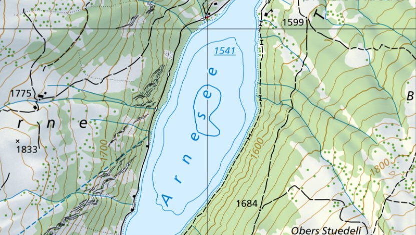
Lake Arnen, tucked away in the Saanenland region, is a true highlight for hikers and nature enthusiasts. This hidden treasure also serves as a starting point for excursions to the neighbouring Pays d’Enhaut or Les Diablerets. Lake Arnen is a reservoir with its surface situated at an altitude of 1,541 metres above sea level, as indicated by the blue, underlined number.
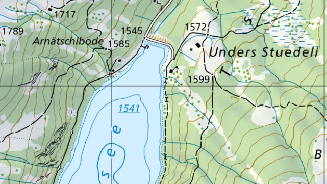
However, the map reveal even more. The brown triangles, known as hachures, at the end of the lake indicate an escarpment. This is a wall of earth that has been built up here. So, is Lake Arnen a reservoir? Yes and no. The 17-metre-high earth-fill dam, completed in 1942, allowed Lake Arnen to be used for generating electricity. The old map from 1938 shows that Lake Arnen already existed as a natural lake at that time, although it was somewhat smaller. The cartographic time travel offers detectives an incredible wealth of such exciting information.
(Zeitreise auf map.geo.admin.ch: Karten der Schweiz - Schweizerische Eidgenossenschaft - map.geo.admin.ch)
What the lake contour reveals on the map
If you take a closer look at the map, you will spot another interesting detail. The contour of Lake Arnen is not the usual solid, continuous line. Instead, it is dotted. For lakes with significantly fluctuating water levels, the shoreline is represented by dots to indicate to skilled map specialists that the shore is not fixed. The story becomes clear here: Lake Arnen, controlled by a dam, is a body of water that can be regulated, and therefore its water level may change. This clarifies why the depth and level of the lake may vary. The values shown on the map are therefore average figures.
Depths and contour lines in lakes
Where this is not the case, it is still possible to estimate the lake’s approximate depth. As with other terrain features, the depth of lakes can also be determined using the contour lines.
The brown contour lines of the surrounding terrain continue into the lake, where they are represented in blue. To the east of the lake (on the right), you will notice a slightly thicker index contour on land (shown in brown) at 1,600 metres. Slightly further to the left, within the lake, there is another index contour (shown in blue). This one runs at 1,500 metres above sea level. Therefore, if the lake level is at 1,541 metres above sea level, we can assume that Lake Arnen is at least 41 metres deep.
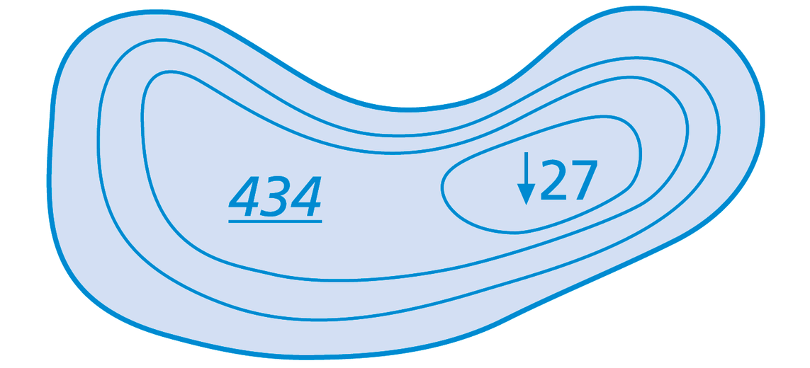
Index contours and spot heights
Counting contour lines is rather laborious and prone to errors. That is why there are so-called index contours and spot heights. These features make it easier to estimate or calculate differences in elevation, both in lakes and on land. Spot heights mark points of specific elevation, typically hills, mountains, depressions, village squares, road junctions, and similar landmarks.
However, index contours are simply regular contour lines that are drawn slightly thicker every 100 metres.
Find out more about contour lines here: Contour lines: The enigma of terrain profiles
Lake depth markers
Remember, every symbol and every line on your map tells a story about the terrain. The better you understand this language, the easier it becomes to navigate.
Be honest: Did you realise that our Swiss national maps contain so much information?
Map reading is in!
Being able to read maps is not just a useful skill for outdoor enthusiasts, it's helpful when planning a trip, too. With a bit of practice and the right information, you can organise your trips even better and impress your friends with your expertise. What's more, our famed Swiss national maps are among the most detailed and precise in the world. By the way: it does not matter whether you use swisstopo maps on your smartphone or on paper, as the key is always the same.
Want to learn more? You can find more information in the signs and symbols list (also known as a key) for all swisstopo maps: Map reading | swisstopo online shop (admin.ch)
Federal Office of Topography swisstopo
Seftigenstrasse 264
3084 Wabern