Switzerland’s Borders – More Than Just a Line on the Map
The national border appears immovable and defines the scope of application for laws and responsibilities. But natural forces or construction projects sometimes require that the border be adjusted. These changes are not arbitrary but are part of a diplomatic process that contributes to Switzerland’s stability.
The venue was the Congress of Vienna in 1815. Behind thick, closed doors, the borders of Europe were being redrawn. Switzerland lost the Valtellina, Chiavenna, Bormio and Mulhouse, but in return was given the area of the current cantons of Neuchâtel and Jura as well as the Fricktal, Rhäzüns, Tarasp and several municipalities around Geneva. Since then, no similar incisive changes to Switzerland’s territory have been made – but Switzerland’s border is in constant flux and requires repeated adjustments.
But this is not merely a matter of discretion. Because a border is more than just a line on the map: it also determines where rules apply, who is responsible for infrastructure and security, and where tax revenues are channelled. Or, to use the words of swisstopo Director Fridolin Wicki: “A national border defines a state’s territory; beyond this point, the law is different.” It is precisely for this reason that Switzerland and its neighbours have to regularly deal with border-related questions – either because of naturally occurring changes or due to construction projects that require an exchange of territory.
A national border defines a state’s territory; beyond this point, the law is different.
Permanent negotiations
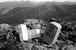
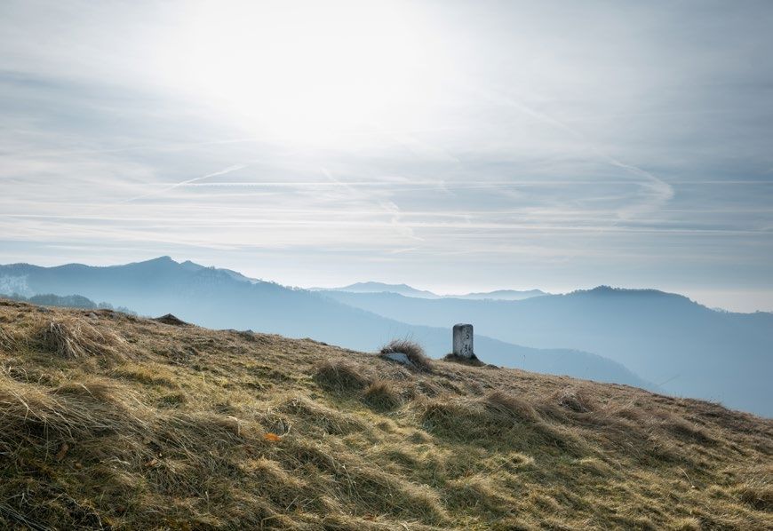
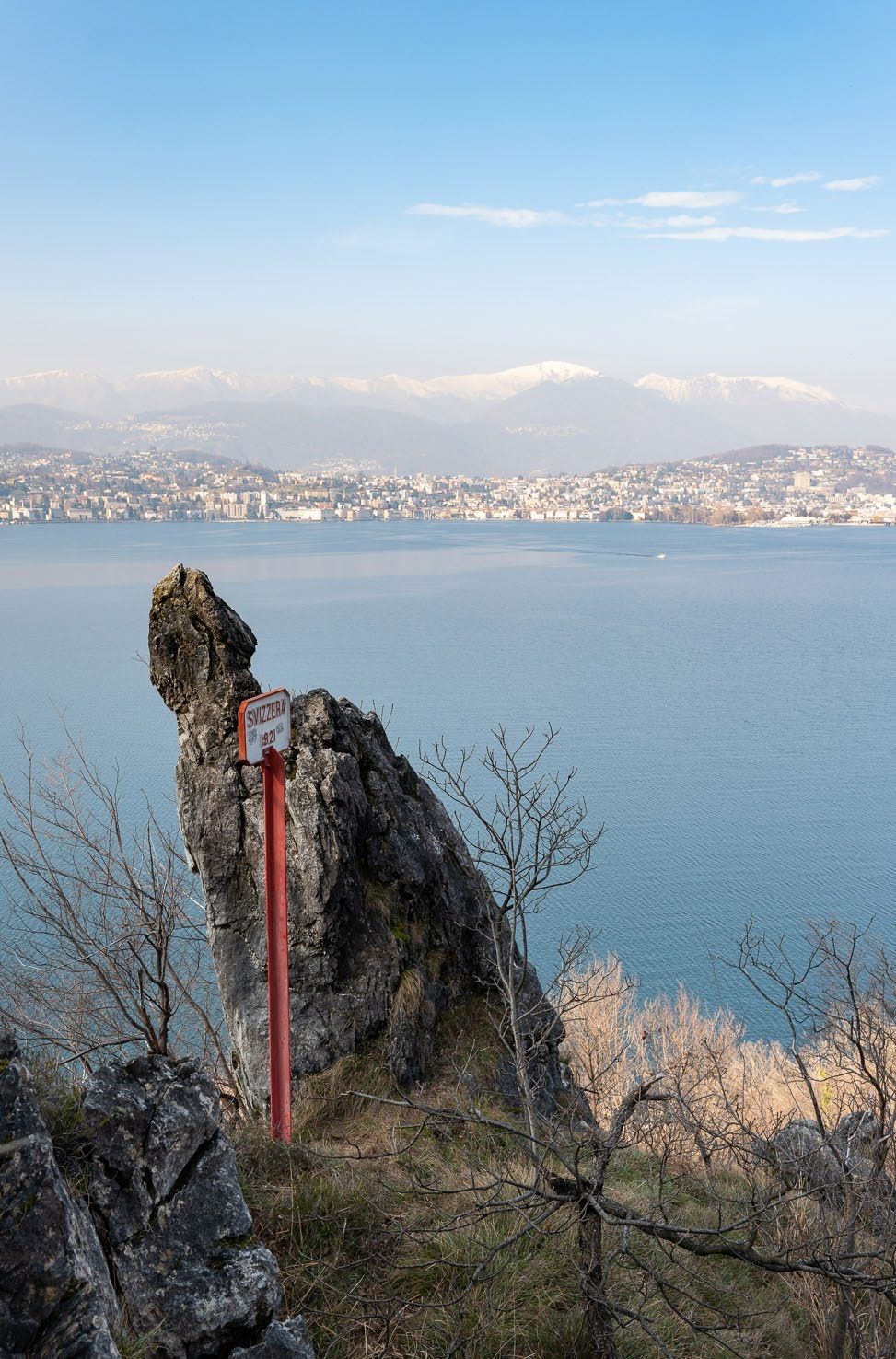
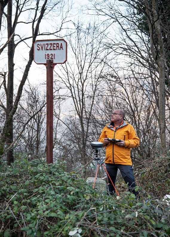
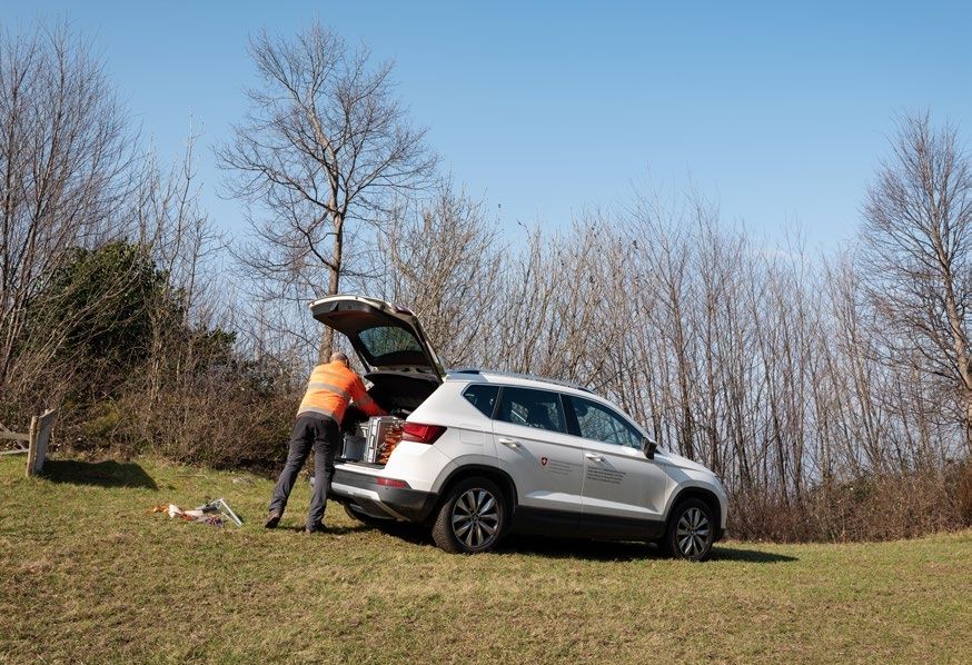
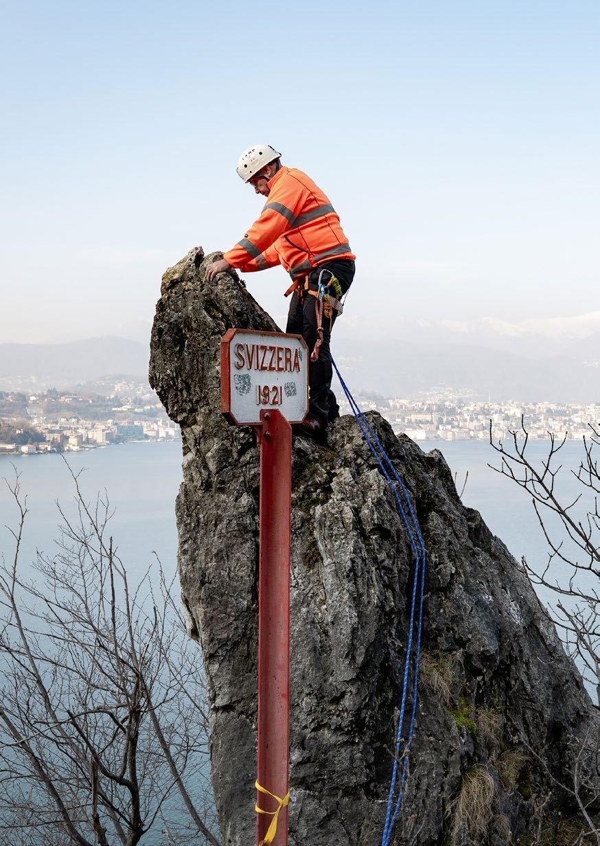
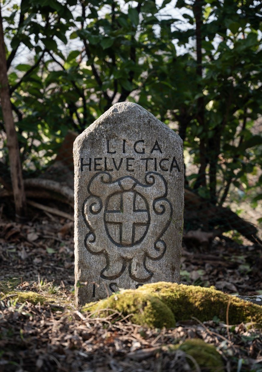
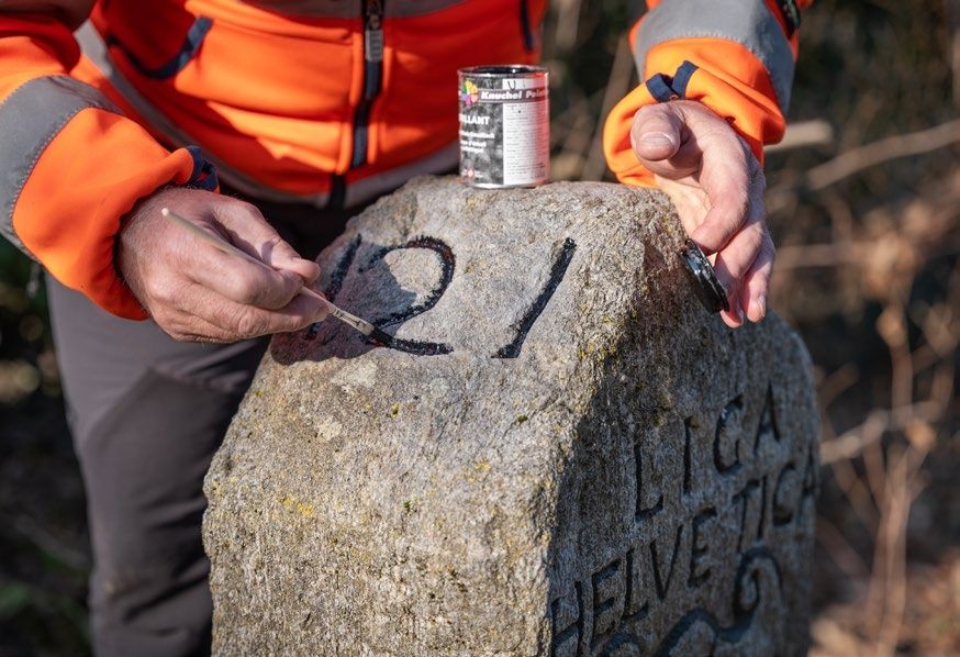
Alain Wicht deals with these questions on a daily basis. As the official responsible for surveying Switzerland’s national borders at the Federal Office of Topography swisstopo, he knows the 1,935 kilometer-long border like the back of his hand. He replaces missing border markers, cleans them and paints them anew. He is regularly on the go along the border, climbing remote peaks or traversing dense forests to make the invisible lines visible that separate Switzerland from its neighbouring countries. Besides working in the field, he regularly hosts delegations or travels to neighbouring countries to discuss questions relating to the border.
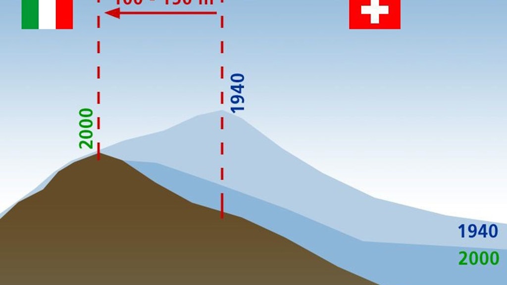
There are several reasons for this. According to Wicht, the most frequent causes of a change in the border are climate change and natural events. The impact of the changing climate on Switzerland’s border is most in evidence at high altitudes. One such incident occurred on the Swiss-Italian border on the Furggsattel above Zermatt: after the Theodul Glacier had receded, a measurement showed that between the former watershed line on the glacier and the current line, which runs along the cliff, there was a difference of 150 metres. The border had to be adjusted, “with the result that the cable car station has since been on Swiss territory and no longer in Italy”, Wicht comments. This example shows that the adjustment of a border can result in not only geographical but also statutory questions that have to be resolved. Who is responsible for the infrastructure, including the maintenance of the station? Which country levies taxes on the revenue generated? And not least: who is responsible for mountain rescue in an emergency?
National sovereignty
It is not only melting glaciers that require a border to be adjusted – sudden natural events also play a role. A relatively current example can be found at the Swiss-Austrian border: in June 2023, around a million cubic metres of rock broke away from the Fluchthorn. Not only was the southern peak 18 metres lower after the rock-slide but the border marker, which had stood on the ridge, was lost. “Here too, nature challenged the territorial sovereignty of both countries”, Alain Wicht explains. Adjustments of this type require clear rules and discussions between the affected countries, however. An agreement is in place with each of Switzerland’s neighbours that governs the control and maintenance of the border. Redrawing a border involves a commission headed by swisstopo that, on the Swiss side, includes representatives from the Federal Department of Foreign Affairs (FDFA), the Federal Customs Administration (FCA) and the cantonal surveyors of the neighbouring cantons. “Our work always involves a lot of diplomacy”, says Wicht.
Cultivating a good relationship
Diplomatic flair is particularly in demand when a construction or transportation project requires a border adjustment. As no state has the right to lay claim to areas of another country, adjustments of this type must always involve an exchange of an equal amount of land. This was the case, for example, when Geneva’s Cointrin Airport was expanded in the 1950s. In 1955, Switzerland and France agreed on an exchange of 40 hectares of land, although the directly affected municipality of Ferney-Voltaire initially resisted. France was granted its own sector on the airport site and an adjacent customs-free road. One year later, the relevant treaty was signed and later ratified.
One project that swisstopo is currently dealing with is the planned bypass road near Allschwil in the Canton of Basel Landschaft. Part of the road would run through French territory in future. This is a situation that the Swiss government wishes to avoid, for reasons of sovereignty. Discussions are currently ongoing between France and Switzerland regarding an exchange of land. This process is often not only time-consuming but shaped by cultural differences and political circumstances.
Even if, at first glance, only Switzerland would benefit from the bypass road, it could also relieve pressure on commuters from Alsace. “This has to be demonstrated”, says Alain Wicht. The initial talks with the French authorities and boundary commissions were positive. Wicht emphasises how important it is to take the necessary time and maintain a good relationship with the neighbours. “Ultimately, we are aiming for solutions that will ensure stable and fair relations with mapour neighbours, not just at the moment but over the long term too.”
Schliesslich streben wir Lösungen an, die nicht nur im Moment, sondern auch langfristig stabile und faire Beziehungen mit unseren Nachbarn sicherstellen.
In flux in future too
Switzerland’s outer border will remain in flux in future too. swisstopo Director Fridolin Wicki says that there will always be cases that require the border to be adjusted. “We will continue to hold talks with our neighbouring countries and provide the technical means to make this possible.” Alain Wicht will still be on the go in difficult terrain in the future, setting up border markers, and then meeting international delegations the following day. As he says: “It is a privilege – both for me, and particularly for Switzerland, if we can work so well together with our neighbours.”
Index
Geography and Responsibility
Switzerland’s external border stretches for 1,935 kilometers. Almost two-thirds of it is defined by natural geographical features such as rivers, lakes, and mountain ridges. In the Alps, the watershed, i. e. the ridge line, forms the border. As a specialized federal agency, the Federal Office of Topography is responsible for the technical updating and maintenance of the national border, in consultation and cooperation with the cantons and neighboring countries.
Additive content

National borders of Switzerland
Switzerland’s national border is formed by the external boundary of its sovereign territory. It is specified, surveyed and maintained in close cooperation with the five neighbouring countries.
Boundaries can change
Borders are commonly regarded as fixes, but depending on the terrain they are subject to climatological changes and natural phenomena and may thus change their course.

Diversity between the lines: Exploring Switzerland’s borders and boundaries
National Maps are more than just practical tools for orientation. They reflect our world and make national borders and local boundaries visible - from the global level down to local details. In Switzerland, there are many beautiful hiking areas close to the borders.
Podcast «Grenzgeschichten» (available in German)
Sie ist beweglicher als gemeinhin angenommen; unsere Landesgrenze. Die neue Staffel des Podcasts swisstopo historic bespricht spannende Fälle von Grenzbereinigungen mit unseren Nachbarländern.
Folio 2025 – For a safe Switzerland
Security extends far beyond the military sphere. It encompasses issues such as the prevention of natural hazards, the sustainable management and supply of resources, the protection of property rights, the stability of infrastructure and the provision of information to the public. Geodata plays a key role in all these areas.