
Official street directory
This directory lists all streets, paths, alleys, squares and named districts that are used as street names for addresses.
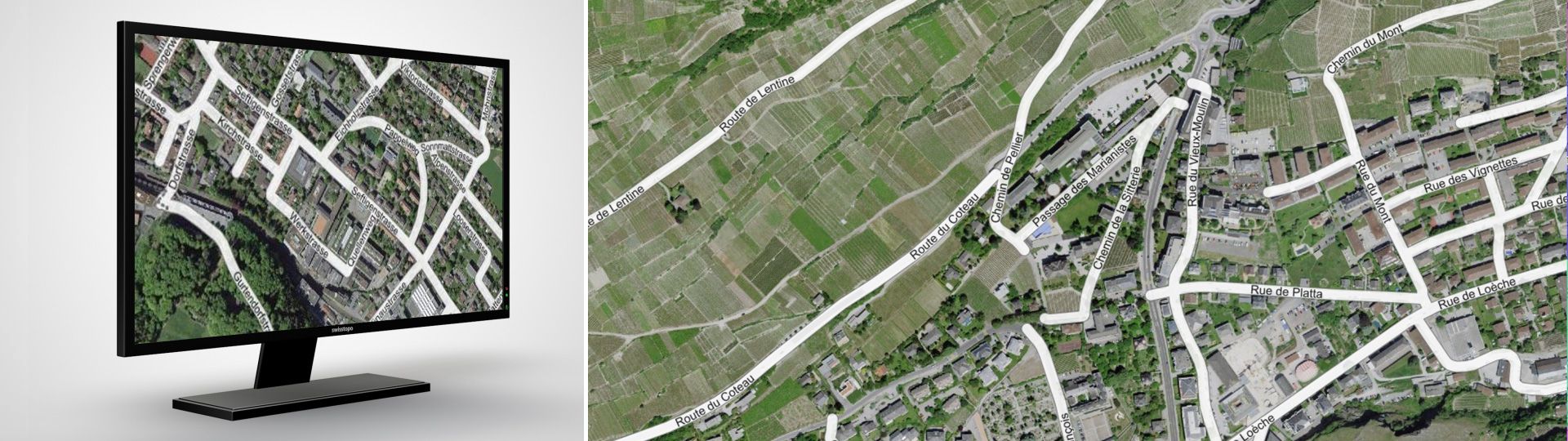
Comprehensive information about Switzerland’s streets
A street name forms an essential and integral part of a building address – a geographic localisation process that we use in our daily lives. In order for a street name to be used for computer-aided administrative tasks or in information systems, a suitable database is required: the official street directory. For every listed street, this directory contains:
- An unambiguous identifier
- A clearly designated street name in each locality – street names in multilingual regions may be listed in more than one language
- The applicable name of the locality and the post code from the official directory of municipalities
- The applicable name and number of the municipality from the official directory of municipalities
- The geographic location of the street
- The status of the street (completed, under construction, etc.).
Changes as of March 2025
For information, the data model and the visualization of the official street directory were updated on March 12, 2025. You can find all the information concerning the changes on swisstopo's geodata news.
Production
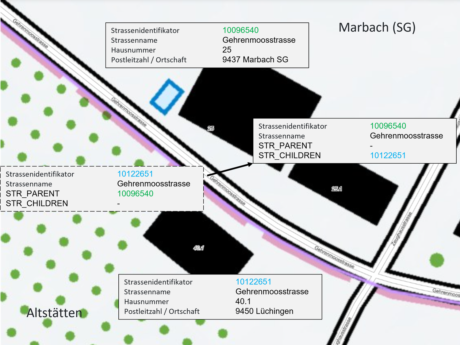
The data stored in the official street directory are based on the data collected for the cadastral survey AV). Each municipality (and sometimes the canton itself) manages the data in the federal buildings and dwellings directory (GWR) that is compiled by the Federal Statistical Office (FSO). The FSO periodically delivers the data to swisstopo, which supplements them with geometric data and subsequently publishes them for use free of charge by everyone.
In order to improve data quality, the AV and GWR data are being harmonised. This work has largely been completed. Only a few municipalities are still working on harmonisation. In these few municipalities (less than 10), the directory is not yet available or not fully available. It is planned that the harmonisation work will be completed by the end of 2024.
Use of the directory
The official street directory can be used by the public authorities, as well as by companies for commercial purposes. For example, it can be used as a database for cartographic products and is also suitable for integration into web services.
Restrictions
The official list of roads in Switzerland only contains those roads where there are building addresses. For this reason, the highways, for example, are not covered comprehensively. The use of the directory is therefore not recommended for routing tasks.
Additional information
Download
Access to the data
FAQ

Index
Federal Office of Topography swisstopo
Seftigenstrasse 264
3084 Wabern