"The solidarity was overwhelming"
Flooding, landslides, villages cut off: the storms in the Maggia Valley at the end of June 2024 claimed seven lives and imposed huge challenges on the response teams. Eleonora Pedrini-Pedroli and Mattia Soldati from the crisis unit of the Canton of Ticino take a look back.
At the end of June 2024, storms in the Maggia Valley caused flooding and landslides. Valleys were cut off and seven people died. You are both in the crisis unit of the Canton of Ticino. What did you do?
Eleonora Pedrini-Pedroli: This was different from Covid, for example, where a cantonal crisis unit was deployed; for this type of incident, the regional crisis unit is responsible. It is managed by the police force of Ticino, and includes the municipalities, civil protection and various rescue organisations. With the storms at the end of June the situation was unclear; there was no overall picture of the situation at first. What was particularly challenging was that many members of the response teams had family and friends in the affected areas.
Mattia Soldati: I was only on duty again on the day after the storm. By this time, the crisis unit had a better overview of the situation and had already taken concrete steps. We were given specific instructions. One of our first tasks was to rectify the damage on the cantonal roads and to provide the crisis unit with digital data.
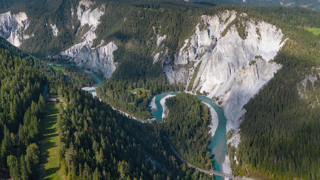
On the Sunday, the crisis unit requested a rapid mapping operation from the federal government, in other words, aerial photographs were to be taken quickly in order to then produce maps. What was the catalyst for this?
Eleonora Pedrini-Pedroli: One week before the storm in the Maggia Valley, rainfall in Misox, Graubünden, had caused mudflows and flooding, and people died there too. The authorities had used the federal government’s rapid mapping service there. An employee in the geomatics office told me that this procedure had helped them to quickly gain an overview so that they could be better organised to deal with the situation. I knew that in an emergency I could contact the Federal Office for the Environment (FOEN). On the Sunday morning, we called FOEN’s standby number and by noon, swisstopo was flying a heli-copter over the area to take pictures. The first pictures were available that evening.
What did these pictures show?
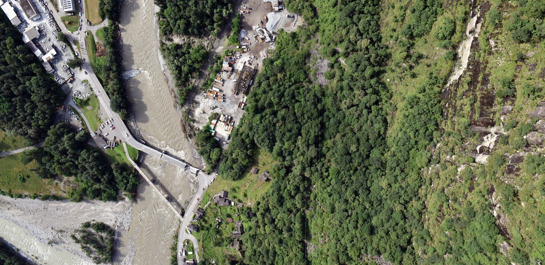
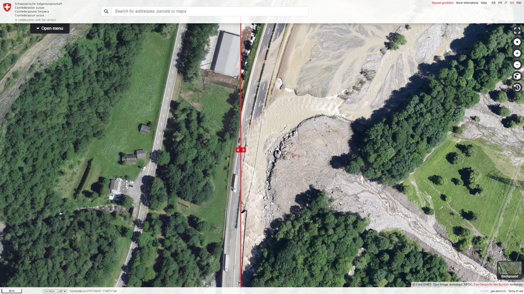
Eleonora Pedrini-Pedroli: We gained an overview of the extent of the destruction. We could determine the size of the flooded areas and where exactly landslides had occurred. The pictures showed where houses had been destroyed, where cars had been submerged and where people still might be.
Mattia Soldati: They also showed the points in the river where material was blocked that could potentially cause further flooding. Later, swisstopo provided additional high-resolution aerial photo data in order to deal with and document the incident, which made it easier to compare the situation before and after the event.
Do you have any suggestions for improvement to make these operations more efficient?
Mattia Soldati: It would have been ideal if swisstopo could have provided us with a digital altitude model, in 3D. This would be a great help in the long term too, for instance for updating the hazard map of the affected areas.
Eleonora Pedrini-Pedroli: I think many people don’t yet know that every municipality and every canton can request rapid mapping if a natural event occurs. It would be good if this valuable service were publicised more broadly. It is also important to mention that this does not involve any additional costs for the affected municipalities and cantons.
Interviewed persons
Eleonora Pedrini-Pedroli has been a member of the Ticino civil protection for 16 years and is responsible for assessing the situation and for triage. She initially completed a Master’s degree in sociology and criminology at the University of Lausanne. More recently, she also earned a Master’s in applied information and data science at the Lucerne University of Applied Sciences and Arts. She lives near Locarno.
Mattia Soldati is a forestry engineer at the Forestry Office of the Canton of Ticino and coordinates the cantonal avalanche service. Among other things, he is responsible for monitoring the glaciers in Ticino, as well as measurements and early warning systems for the forestry service. He completed a degree in forestry engineering at the Berne University of Applied Sciences in Zollikofen and lives in the Verzasca Valley.
Additive content
Rapid Mapping
Rapid Mapping is a federal government service that collects and makes available geodata such as aerial or satellite imagery following natural disasters, in order to manage and document these events. The relevant authorities at all federal levels (federal government, cantons, communes) are actively supported in assessing and documenting the impacts of natural events.
Rapid Mapping deployments 2024
Between 21 June 2024 and 2 July 2024, four rapid mapping missions were launched to document and manage these events (Misox, Valais and Ticino). The corresponding rapid mapping products can be viewed here.
Folio 2025 – For a safe Switzerland
Security extends far beyond the military sphere. It encompasses issues such as the prevention of natural hazards, the sustainable management and supply of resources, the protection of property rights, the stability of infrastructure and the provision of information to the public. Geodata plays a key role in all these areas.