
Digital Siegfried Map
The Siegfried Map was the first set of 1:25'000 and 1:50'000 maps of the whole of Switzerland.
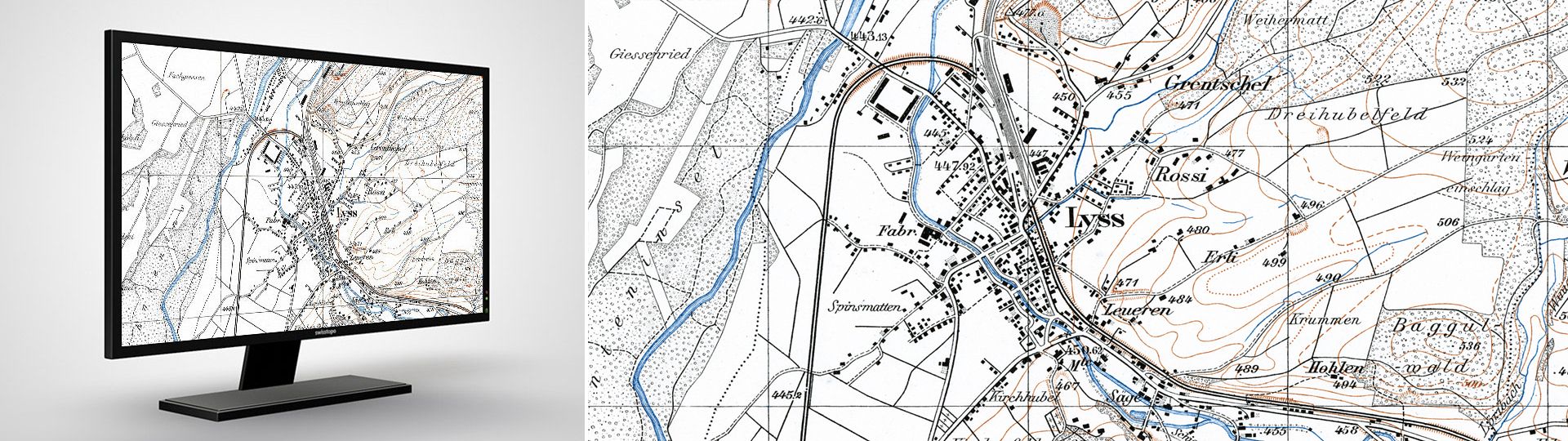
Georeferenced Siegfried Map
The Topographical Atlas of Switzerland was published over the period from 1870 to 1926. This was the first complete detailed map series for the whole of Switzerland. It was published at 1:25'000 scale for the lowland areas of the Mittelland, the Jura and south Ticino, and at 1:50'000 scale for alpine regions. With periodic campaigns of revision up to 1949, in all over 4000 revised sheets were published. Every edition has now been scanned and is available in digital form for research into the development of the Swiss landscape and a host of other applications.
- The Siegfried Map - a unique national treasure in digital form.
- Historical maps as a guide for studying the changing landscapes and for historical research.
- The Central Plateau, the Jura Mountains and southern Ticino at the scale 1:25'000, and the Alps at the scale 1:50'000.
- Over 4000 maps with various dates of issue.
Official name: Topographischer Atlas der Schweiz (TA)
Reference system: CH1840
Projection: Flächentreue unechte Kegelprojektion
Point of origin for height measurements: Repère Pierre du Niton 376,86 m. ü. M. = 'alter Horizont'
The first official map series were originally published in 1870 at the same scale as the topographic surveys (1:25'000 and 1:50'000). However, Switzerland was divided in two parts: one published in 1:25'000 scale, the other in 1:50'000 scale, both partly overlapping:
Siegfried map 1:50'000
- Aera: Alps
- Method of ground representation: contour lines 30 m
- Method of reproduction: lithography (from 1910 also copperplate engraving)
- Method of printing: planographic printing
- Colours: 3
- Map format: 35 x 24 cm = 210 km2
- Number of sheets: 142
- First edition: 1870 - 1926
- Revision: until 1949
Siegfried Map 1:25'000
- Area: Jura, Central Plateau and Southern Ticino
- Method of ground representation: contour lines 10 m
- Method of reproduction: copperplate engraving
- Method of printing: intaglio printing (from 1905 also planographic printing)
- Colours: 3
- Map format: 35 x 24 cm = 52,5 km2
Sheet Division of the Siegfried Map
Price and ordering
The dataset is not available for free download. Please send your orders to geodata@swisstopo.ch who will make an offer for the costs of the provision of the data. To facilitate the order, please specify the area of interest (rectangle in Swiss coordinates, municipality, etc.), the format and, if necessary, the resolution or variant.
Additional information
Index
Federal Office of Topography swisstopo
Seftigenstrasse 264
3084 Wabern