
Historical maps
The swisstopo map collection is a unique cultural treasure comprising all first editions and revised versions of the official «Dufour Map», the «Siegfried Map» and the series of national maps. The collection also contains a variety of documents, including handwritten items. All editions of the maps produced in analogue form can now be obtained in digital form or conveniently viewed chronologically in swisstopo’s map viewer.

Most comprehensive collection of Swiss historical geodata
With the official maps produced from 1840 onwards, together with their largely hand-drawn documentation, swisstopo’s map collection contains Switzerland’s oldest geographic reference data. The approximately 36,000 printed maps and 25,000 manuscript maps (hand-drawn originals) form the most comprehensive collection of historical geodata in Switzerland. The swisstopo map collection has been listed in the Swiss Inventory of Cultural Property as a collection of national importance since 2021.
Cultural treasure and landscape memory
Although it was originally conceived as a pure archive of outdated maps, since 1838 swisstopo’s collection has evolved into a cultural treasure of national importance. Taken together, the items in the collection represent a comprehensive record of the development of Switzerland’s landscapes.
Visualisation of Switzerland's landscape andresidential development
With the aid of the sets of historical maps it is possible to trace the evolution of Switzerland’s landscape and the history of its residential development right back to the era before the founding of the Swiss Confederation. swisstopo introduced a visualisation service in 2013 that enables users to embark on a fascinating and informative journey through history. With the aid of the sets of historical maps it is possible to trace the evolution of Switzerland’s landscape and the history of its residential development right back to the era before the founding of the Swiss Confederation. A journey through time is available in the federal geoportal that can be used for viewing maps dating from any desired era.
swisstopo as authority responsible for the collection of national maps
swisstopo is required by law to permanently place this national treasure at the disposal of the public for a broad variety of uses, and it fulfils this requirement in the following ways:
- Compilation
swisstopo places the collection of national maps at the disposal of the public by posting them on the various portals. Users can search for any desired historical map sheets via the online catalogue of federal administration libraries Alexandria, by visiting the Kartenportal.ch website or by clicking on the historical maps (journey through time
link see above).
- Digitisation
swisstopo has produced high-resolution scans of the original historical analogue maps, and these digital products can now be ordered from swisstopo. The Dufour Map, Siegfried Map and sets of national maps are also available online via map.geo.admin.ch, where they can be compared with the present-day maps with the aid of a variety of tools.
- Protection and preservation measures
swisstopo’s map collection is protected in specially enclosed and air-conditioned premises which are not open to the public. The maps are kept in special flat, acid-free receptacles. swisstopo personnel repair and restore any damaged items wherever necessary.
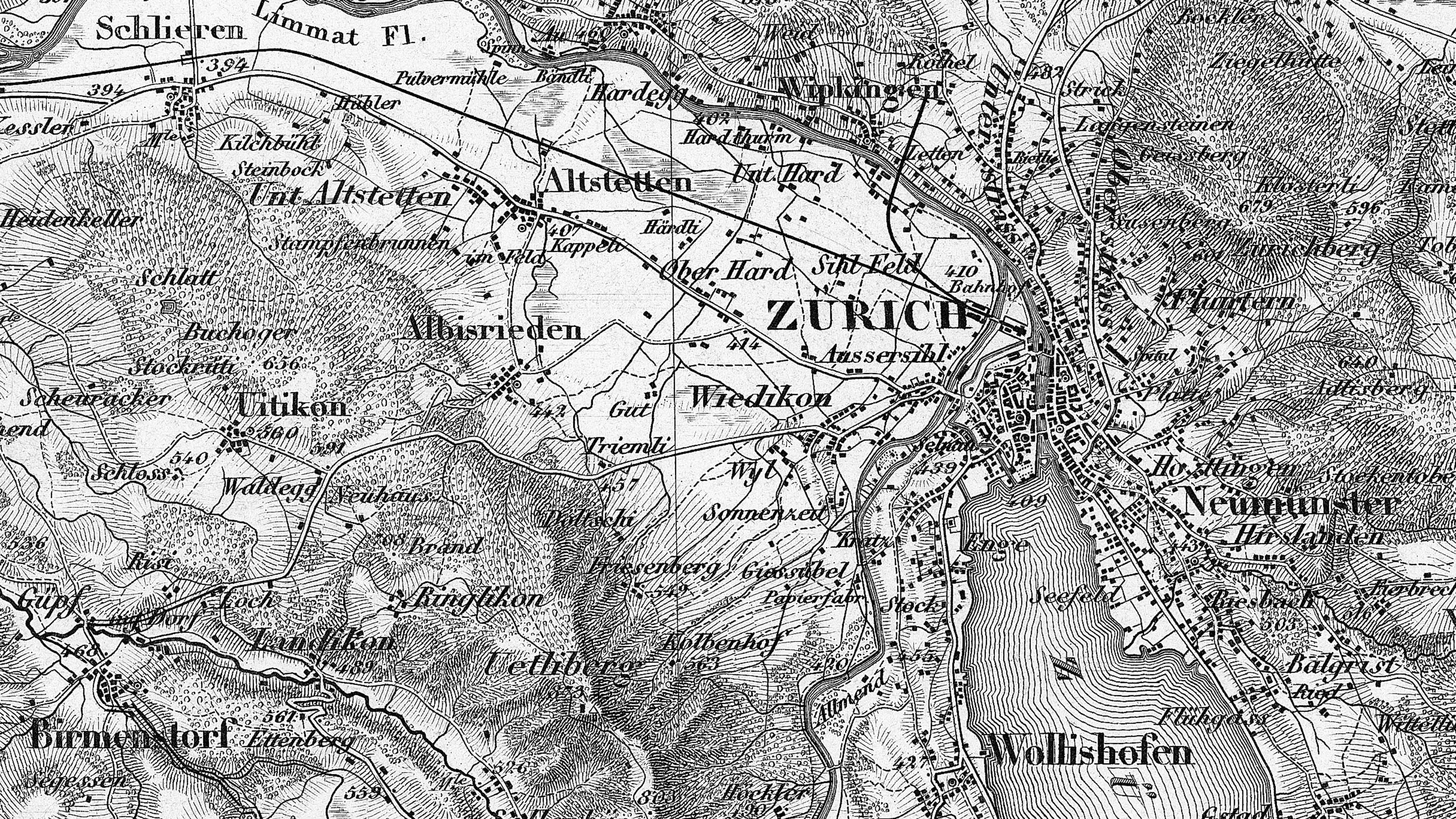
Dufour Map
The 1:100,000 topographic map of Switzerland (Dufour Map) was the first official series of maps that encompassed the whole of the country. It was published in the period from 1845 to 1865 and thus coincides with the creation of the modern Swiss Confederation.

Siegfried Map
The original surveys for the Dufour Map were used for the publication of the 1:25,000 / 1:50,000 Topographic Atlas of Switzerland (Siegfried Map), which was produced between 1870 and 1926 as a co-operation between the federal government and the cantons, based on two Federal Acts dating from 1868.
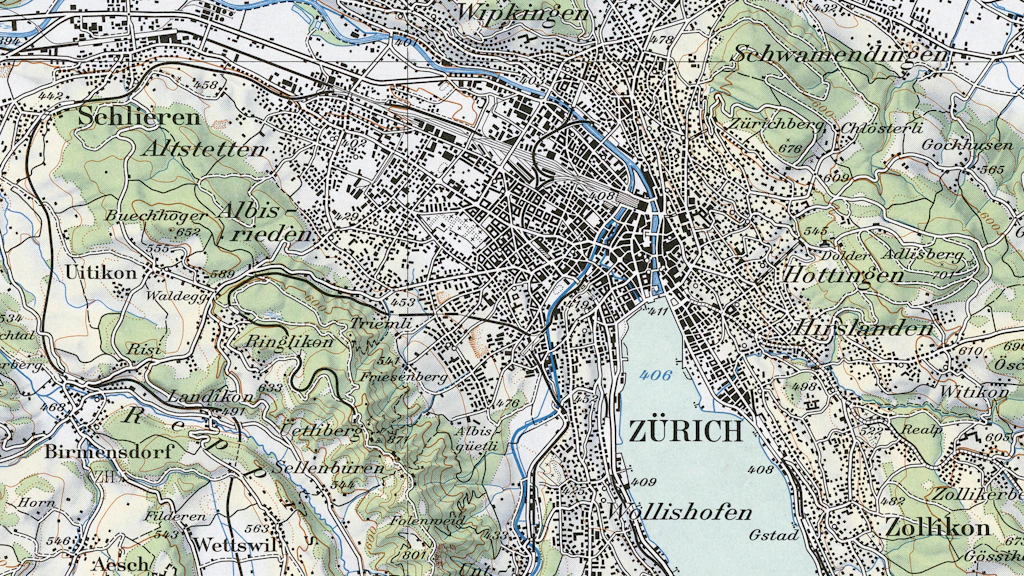
National Map (history)
The national maps of Switzerland that are in use today are based on the provisions of the legislation dating from 1935. These maps were implemented at varying scales and subsequently replaced the Dufour and Siegfried maps and their supplements.

Georeferencing
The geodata produced by swisstopo are stored in a defined geodetic reference system.

Historical Swiss reference systems
In the 19th century – before the introduction of reference system CH1903 for the Swiss national survey – other reference systems and map projections were used, especially for producing the Dufour and Siegfried maps. These parameters are still useful today for analysing historical data. In addition to these two main map series, other special reference systems were developed in the second half of the 19th century, but they will not be dealt with here.

A journey through time – maps and aerial photographs
Take a journey through time with swisstopo’s historical maps and aerial photographs and get to know Switzerland from the past and the present.
Federal Office of Topography swisstopo
Seftigenstrasse 264
3084 Wabern