
Digital Dufour Map
The Topographical Map 1:100'000 (Dufour Map) is the first modern official map series of Switzerland.
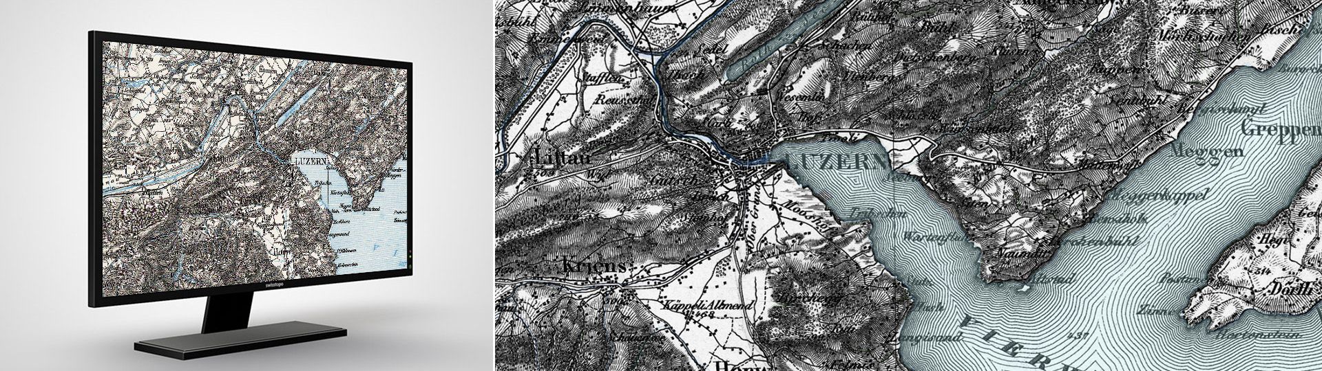
Topographical Map (Dufour Map 1:100'000)
It was first published between 1845 and 1865, and subsequently updated to 1939. Every edition has now been scanned and is available in digital form for research into the development of the Swiss landscape and a host of other applications.
The so-called Federal and Cantonal topographic surveys served as a basis for the publication of the Dufour Map. This is the first modern official map series of Switzerland.
All earlier editions are in the map collection.
Official name: Topographische Karte der Schweiz (no official English name)
Reference system: CH1840
Projection: Equivalent conical projection
Point of origin for height measurements: Repère Pierre du Niton 376,2 m above sea level = 'old horizon'
Production
- Method of ground representation: obliquely luminated hachures
- Method of reproduction: copperplate engraving
- Method of printing: intaglio printing (from 1905 also planographic printing)
- Colours: 1 (from 1908: 2, from 1938: 3)
- Map format: 70 x 48 cm = 3360 km2
- Number of sheets: 25
- First edition: 1845-1865
- Revision: until 1939
Product specification
- File format: TIFF
- Georeferencing: TFW-File
- Resolution: 508 dpi
- Coordinate system : CH1903 (CH1903+ on demand)
- Delivery unit: entire map sheet without a frame
Price and order
The dataset is not available for free download. Please send your orders to geodata@swisstopo.ch who will make an offer for the costs of the provision of the data. To facilitate the order, please specify the area of interest (rectangle in Swiss coordinates, municipality, etc.), the format and, if necessary, the resolution or variant.
Additional information
Index
Federal Office of Topography swisstopo
Seftigenstrasse 264
3084 Wabern