
swissSURFACE3D: Milestone achieved and course set for the future
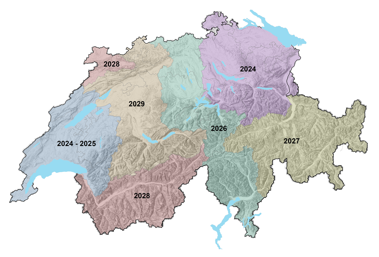
With the release of data for the Canton of Bern, uniform and highly precise LiDAR data from swissSURFACE3D is now available for all of Switzerland and the Principality of Liechtenstein. The nationwide survey, launched in spring 2017, was carried out in six stages and took a little more than seven years to complete. Due to high demand and positive experiences, swisstopo has initiated a new LiDAR survey to ensure the continued update of swissSURFACE3D and swissSURFACE3D Raster products.
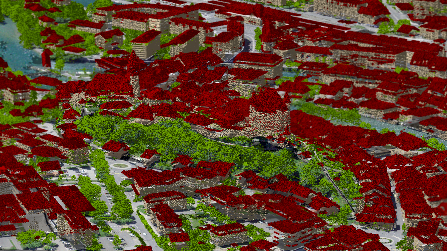
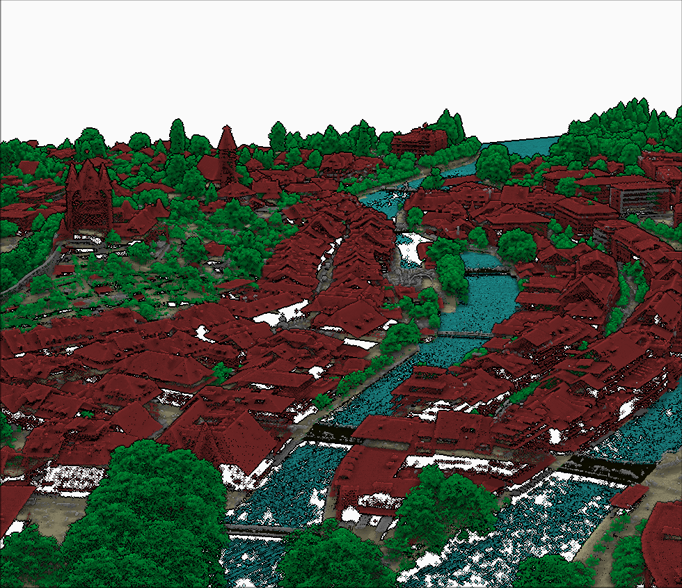
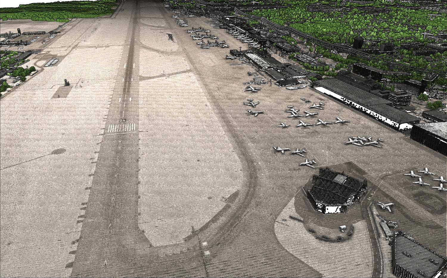
Application examples of LiDAR data at swisstopo
swissALTI3D updates
swisstopo primarily uses LiDAR data to update existing terrain models. Both the point density and the precision of the measurements result in a significant improvement in quality. Additionally, the data now extends farther beyond the Swiss national borders, meaning that, for example, the Matterhorn is now fully covered by swissALTI3D data. By 2025, the 50 cm raster cell resolution of swissALTI3D will be fully based on high-resolution LiDAR data across Switzerland. Before-and-after comparisons using shaded relief clearly illustrate these improvements.
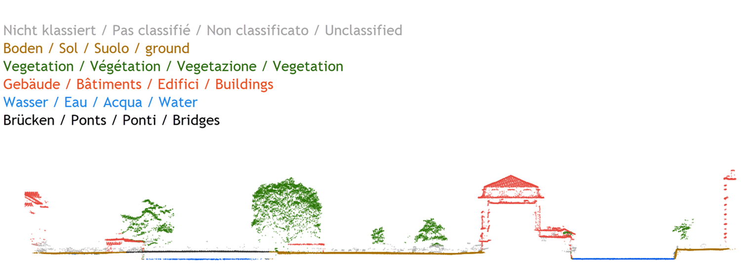
New surface model: swissSURFACE3D Raster
A digital surface model (DSM) differs from a digital terrain model in that it represents the terrain along with vegetation and artificial structures such as buildings or bridges. Using LiDAR data from swissSURFACE3D, swisstopo can derive swissSURFACE3D Raster. This is a current, high-resolution, and almost fully automated DSM that is released shortly after the LiDAR data collection.
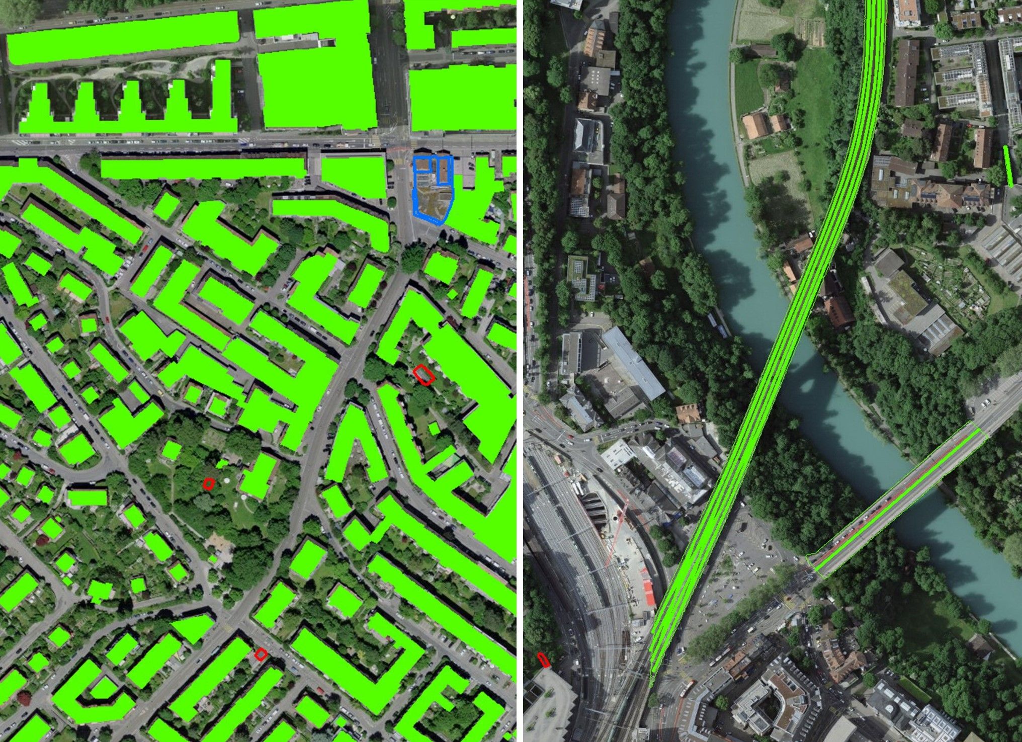
Change Detection for swissTLM3D Production
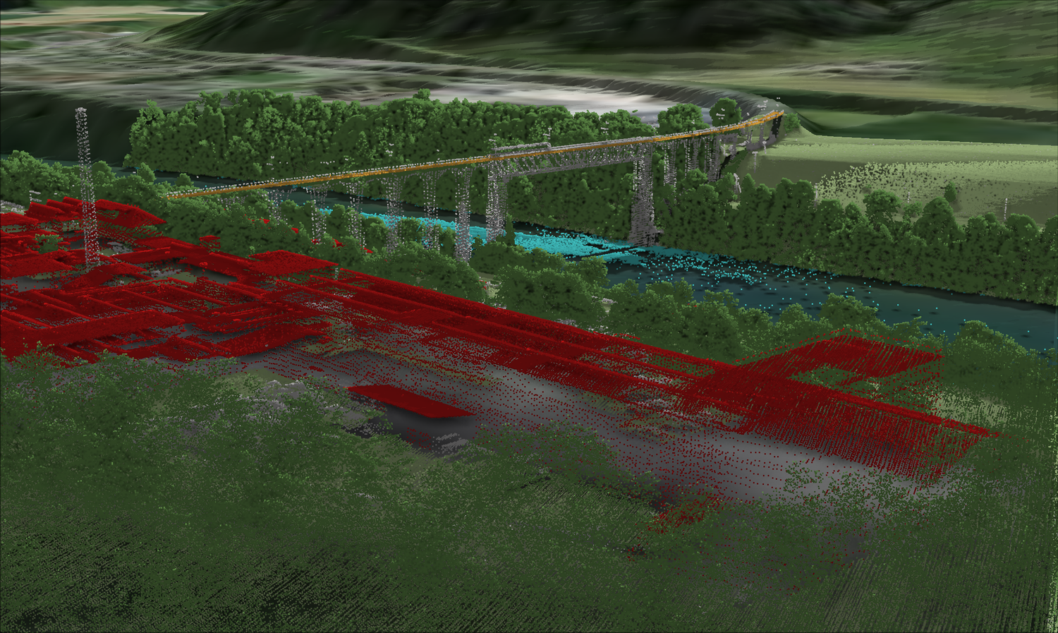
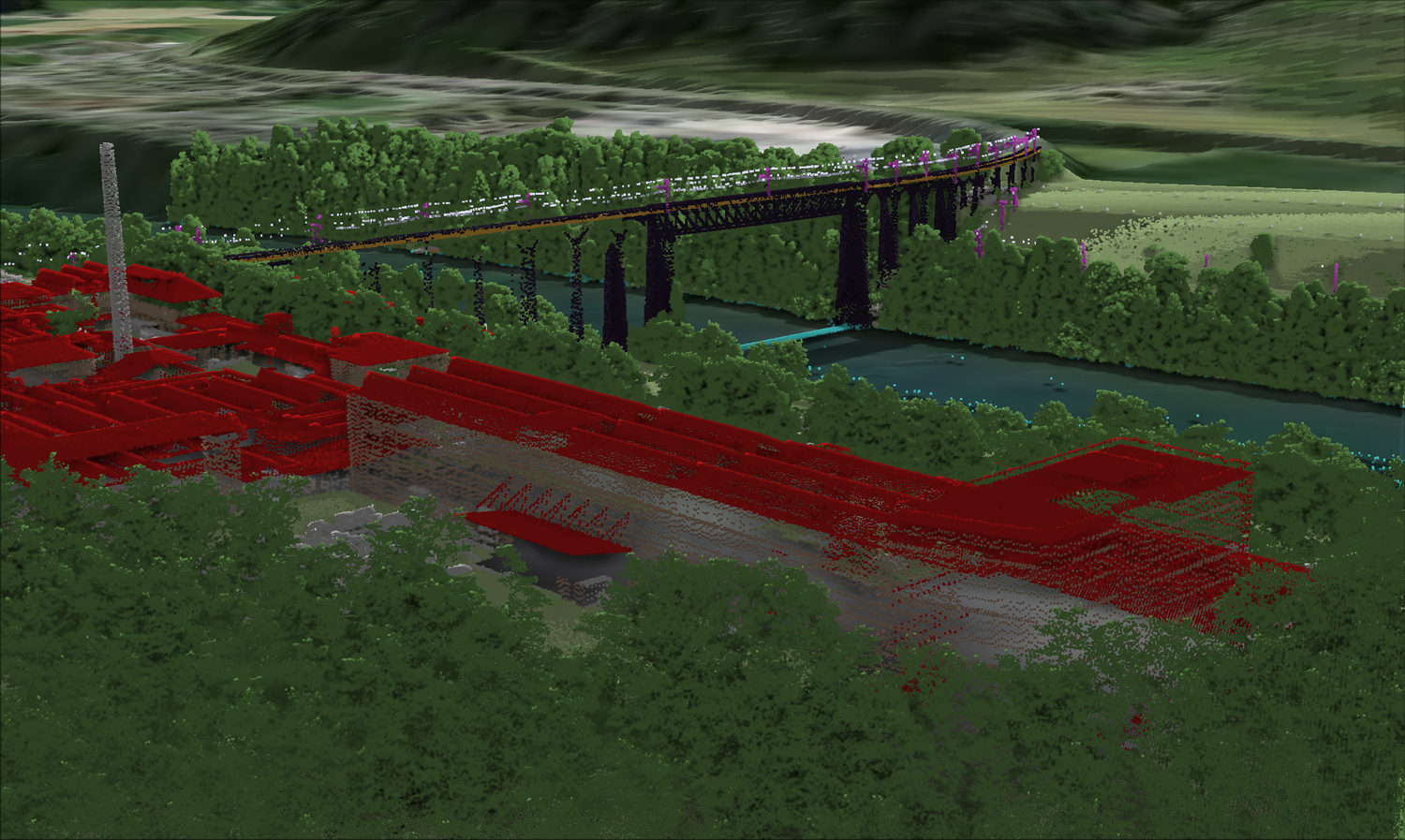
A frequently used product from swisstopo is swissTLM3D – the topographic landscape model of Switzerland. It includes both natural and artificial objects and represents them in three dimensions. The landscape is constantly changing, and all modifications must be detected and updated. Classified LiDAR data is also used for this purpose. Buildings or bridges, for example, can be extracted from the LiDAR point cloud based on their classification. These are then compared with the existing TLM dataset, and detected differences ultimately indicate possible changes.
External Applications
Archaeology
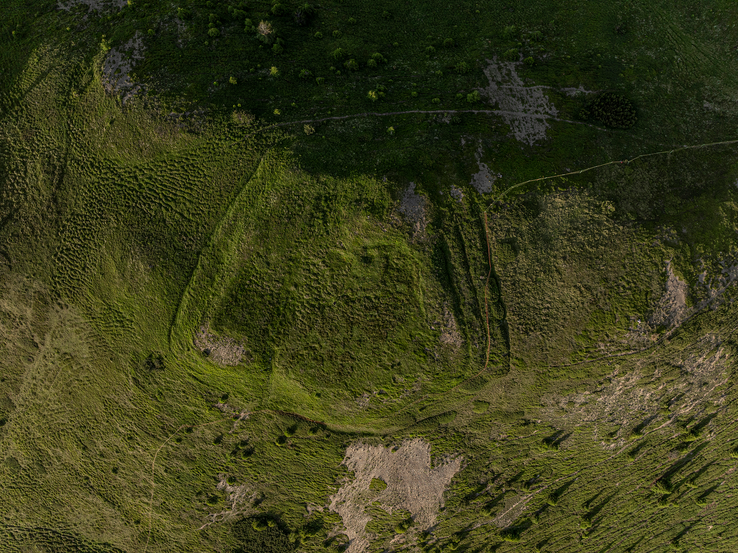
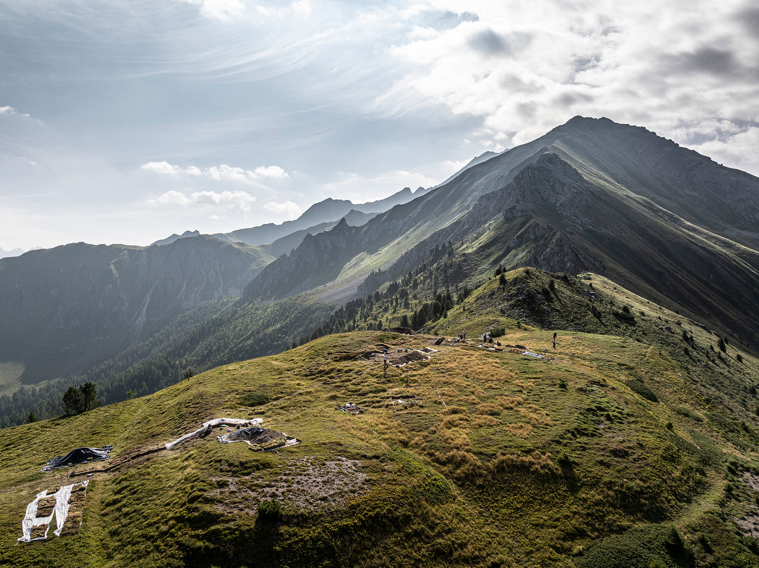
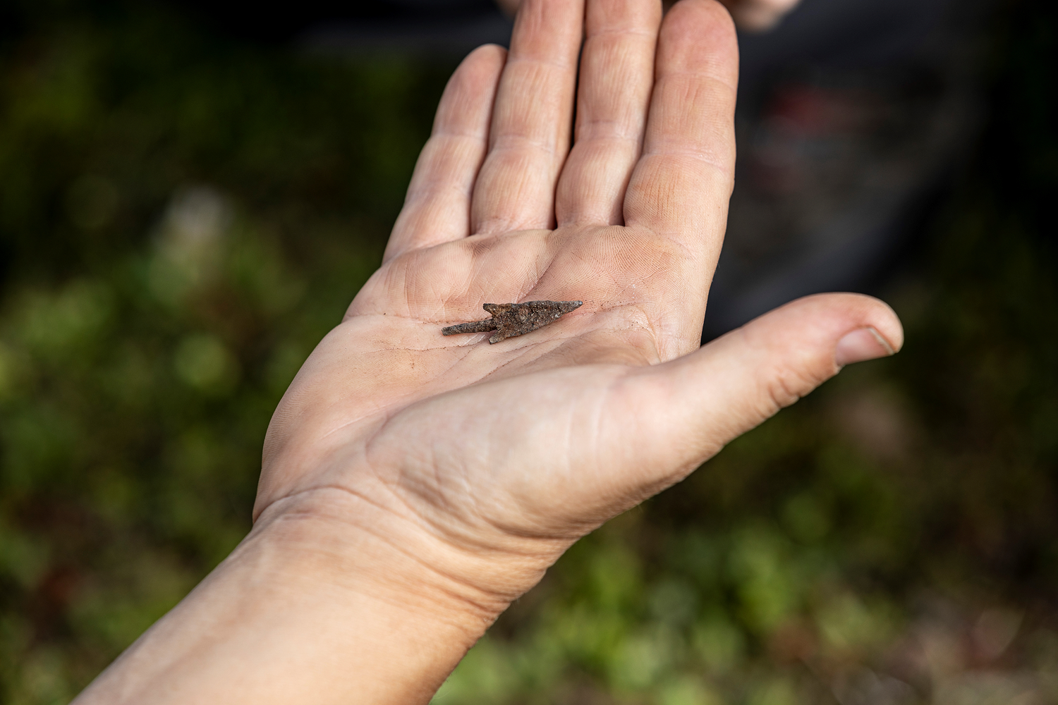
In the fall of 2023, a volunteer detectorist discovered a striking terrain structure in the Colm la Runga area, about 900 meters above an ancient battlefield. He used the shaded relief of the digital terrain model swissALTI3D, which is based on the high-resolution LiDAR data from swissSURFACE3D, capable of detecting even the smallest elevation differences in the landscape. Since archaeological finds and sites (including those discovered through LiDAR) belong to the public, the volunteer, who collaborates with various cantonal archaeology offices, reported the discovery to the Archaeological Service of Graubünden. The striking terrain structure turned out to be an artificial fortification on a hilltop with multiple ditches and embankments. Initial findings and investigations indicate that it is indeed a 2,000-year-old Roman military camp. More details: Newly discovered Roman military camp in the Grisons.

Landscape and Urban Planning
Researchers and architects from the Large Scale Virtualization and Modeling Lab at ETH Zurich use swissSURFACE3D LiDAR point clouds as a foundation for a holistic approach to landscape and, in particular, urban design. The LiDAR data serves three key components:
- Modeling terrain: Terrain models enable a better understanding of spatial structures and the development of site-specific solutions.
- Scientific Visualization: Biophysical properties such as elevation differences, slope inclinations, or vegetation patterns can be derived, thereby supporting an analytical and design-oriented engagement with the landscape.
- Computation of landscape physics: Terrain models derived from LiDAR data can, for example, be combined with climatic or hydrological data to simulate the effects of urban heat islands or impervious surfaces. Such simulations are essential for sustainable urban development.
The following video illustrates the three components using an example of an urban design for the Carouge municipality in the canton of Geneva.
Outlook
As part of the new campaign, the cantons of Appenzell Innerrhoden and Appenzell Ausserrhoden, Glarus, Schaffhausen, Schwyz, St. Gallen, Thurgau, Zug, and Zürich have already been surveyed. These data are currently being processed and will be continuously published in the coming months. And the work continues: LiDAR data is currently being continuously collected in the Romandie (blue block). By 2030, the data should be available nationwide.
New Features
Considering customer feedback and LiDAR technology advancements, the next version of swissSURFACE3D will include:
- Higher point density: minimum 10 pulses per m².
- Additional classes: facades, power poles, power lines, bridge pillars / supporting structures
- Synthetic points on water bodies and under bridges
- Normalized intensity values for cross-region comparisons
- A new data format: cloud-optimized point cloud (.laz) instead of zipped .las files
For questions or suggestions regarding measurement campaigns, swissSURFACE3D, or geodata in general, feel free to contact geodata@swisstopo.ch. Stay updated through the geodata newsletter: Subscribe to Geodata Newsletter