
swisstopo app
Discover even the remotest places in Switzerland with high quality maps. The free map app from swisstopo lets you combine the National Maps of Switzerland with many other topics such as hiking, cycling, snow sports and aviation on your smartphone and tablet. Ease of use and functionalities for planning and recording tours as well as experiencing the landscape in panorama mode, are some of the highlights of the app.
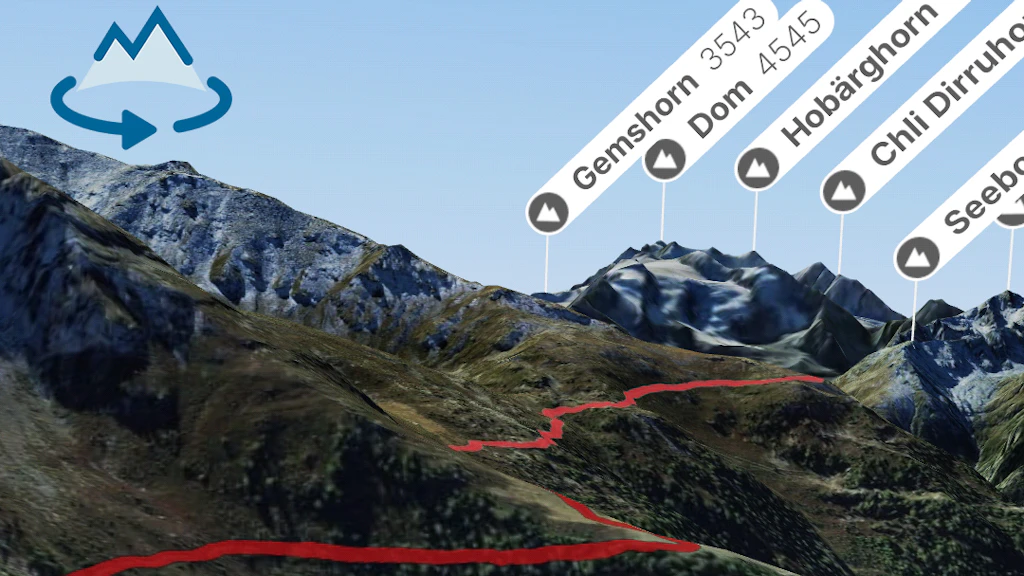
Better orientation with landmarks

Tapping on a landmark will reveal further information.
Find out more now
Download app
.png?auto=format)

General information about the swisstopo app
Discover even the remotest places in Switzerland with high quality maps. The free map app from swisstopo lets you combine the National Maps of Switzerland with many other topics such as hiking, cycling, snow sports and aviation on your smartphone and tablet. Ease of use and functionalities for planning and recording tours as well as experiencing the landscape in panorama mode, are some of the highlights of the app.
Contents and functions of the swisstopo app
The swisstopo app presents a wide range of content and topics and offers functions for use in your leisure time and at work.

Need useful tips?
The most frequently asked questions about the swisstopo app

Create QR codes for suggested routes
Display the most popular routes in a clear and simple manner in the swisstopo app - this can be done in no time at all using individual QR codes. Create these practical codes yourself in just a few steps using the instructions provided.

Software Development Kit
With the Open Source Software Development Kit "Open Swiss Maps SDK" you can easily integrate the popular swisstopo national maps and geodata into your app.

Privacy policy and terms of use
Here you will find the privacy policy and the terms of use for the swisstopo app.
Federal Office of Topography swisstopo
Seftigenstrasse 264
3084 Wabern