
On the go – with the swisstopo app
Planning trips? Now even easier with the swisstopo app – whether spontaneous or for next weekend. You can now get real-time information such as delays, disruptions, or track details for your public transport connections. In addition, the base map has been optimised thanks to valuable customer feedback.
A better overview when planning your trips
To help you better assess the terrain and surroundings when planning your tour and once you are there, the hiking section now includes a slope gradient layer. This uses colors to show you immediately where it gets steep or exposed.
You can now also name waypoints and intermediate destinations when planning your tour, allowing you to divide your tour into even more individual sections.
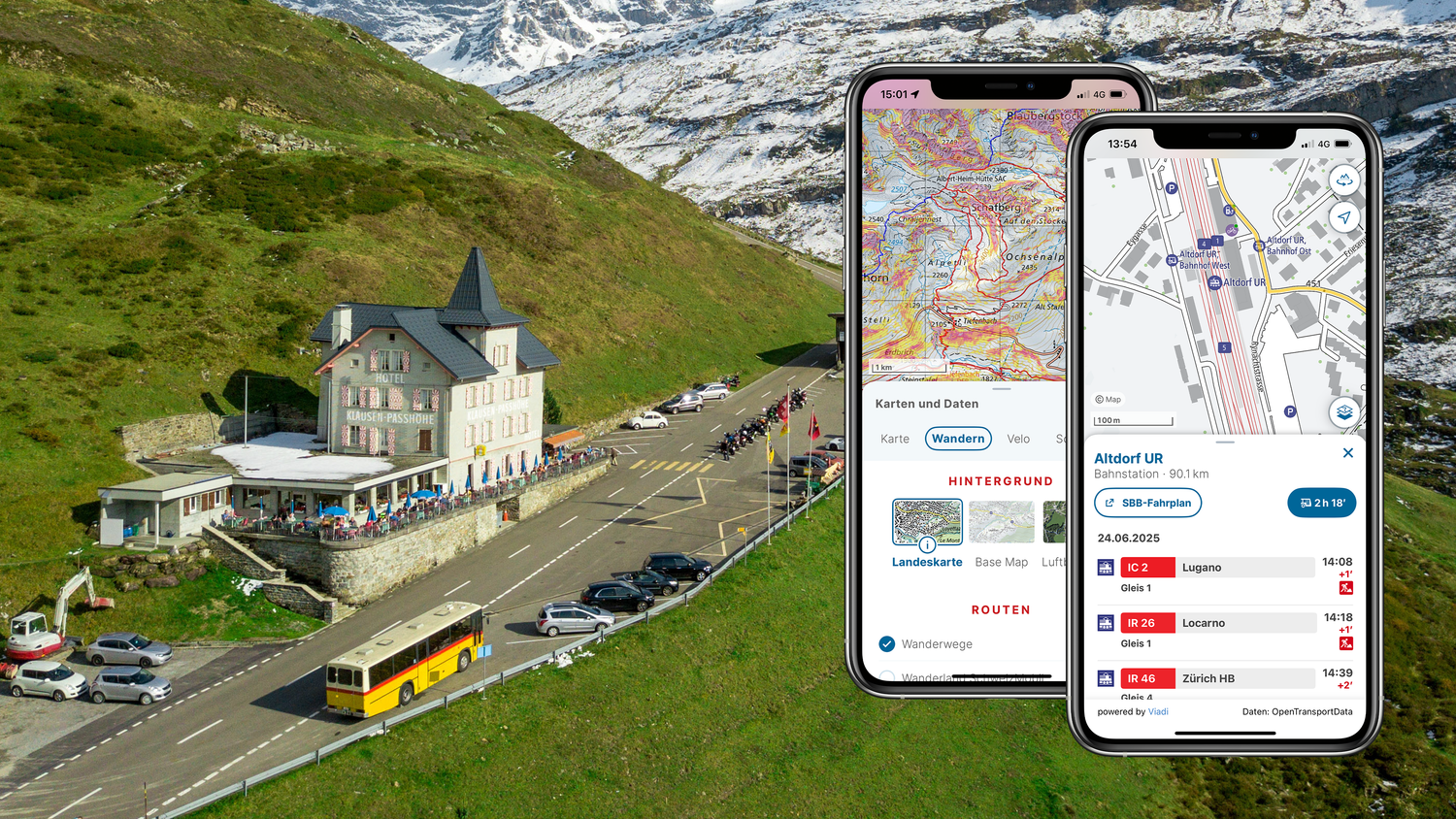
Real-time information on public transport connections
You can now plan your next trip by public transport conveniently in the swisstopo app. Simply select the desired date and time to check connections at a later point in time. With the new real-time information, you are now also kept up to date on track changes, disruptions, or delays affecting your public transport connection. The Base Map even shows you the platform edge or track for your connection – so you'll never miss a train again.
Base Map
Based on the survey conducted on the Base Map, we have further developed the interactive background map. We have improved readability with increased contrast and slightly stronger colors, larger symbols, and fonts.
You can also find out which mountain railways are currently in operation in the Base Map and obtain information about the facilities, such as seasonal and operating times, contact details and capacity.
More information about the Base Map
More information about the swisstopo app
.png?auto=format)