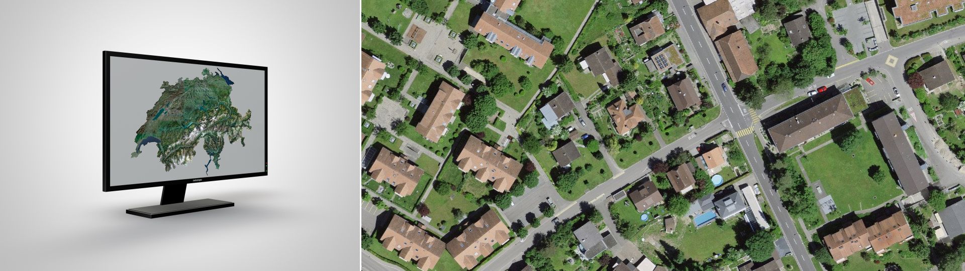
The orthophoto mosaic SWISSIMAGE 10 cm is a composition of new digital color aerial photographs over the whole of Switzerland with a ground resolution of 10 cm in the plain areas and main alpine valleys and 25 cm over the Alps. It is updated in a cycle of 3 years.
The Digital Color Orthophotomosaic of Switzerland
Images that have been freed of their distortions and therefore show a uniform scale over their entire surface, are designated as orthoimage. They can for instance be overlaid with other geodata and serve as a basis for accurate measurements of coordinates, distances and surfaces.
Applications
The field of applications of orthophotos is as various as the content of its underlying aerial photographs.
SWISSIMAGE forms the ideal basis for your applications in the fields of land-use planning, natural hazards management, environmental protection, forestry and agriculture, geology or can be simply used as a detailed base map.
By default, SWISSIMAGE contains the most recent orthophotos. However, older orthophotos can be displayed thanks to the Journey through time – aerial images and are included in the SWISSIMAGE HIST product.
Access to data
Data from 2017 onwards is available for download. Earlier data must be ordered from geodata@swisstopo.ch. We will then prepare an offer containing the service fees. To facilitate your order, please specify the area of interest (rectangle in Swiss coordinates, municipality, etc.), the format and, if necessary, the resolution or variant.
Coordinate systems: LV03 from 2005 to 2007, LV95 since 2008
Ground resolution: 0.25 m or 0.5 m (depending on the area)
Standard deviation for the precision in position: +/- 0.25 m for the ground sample distance of 0.25 m (in hilly terrain +/- 3-5 m).
Data format: RGB TIFF (3 x 8 bit) with TFW (World File)-georeference.
Images from 1998 to 2005 (SWISSIMAGE 50 cm)
Coordinate system: LV03
Ground resolution: 0.5 m
Standard deviation for the precision in position: +/- 0.5 m.
Data format: RGB TIFF (3 x 8 bit) with TFW (World File)-georeference
Publications concerning SWISSIMAGE are available only in German and French. Please select your preferred language in the navigation bar, to access the desired document.
The SWISSIMAGE product is a mosaic of several orthorectified aerial images. The year assigned to each tile in the mosaic corresponds to the flight year of the image used to produce at least 70% of the tile. To find the exact date of acquisition of the images used in production, you need to retrieve the flight date available in the digital aerial strips or in the individual aerial images for older periods. A detailed breakdown of the images and therefore the dates used to produce the tile ("seamlines") is not available.
All this information is available directly from the mapping portal by clicking on the various displayed elements.