
Digital Old National Maps
Georeferenced old National Map 1:25'000 / 1:50'000 / 1:100'000
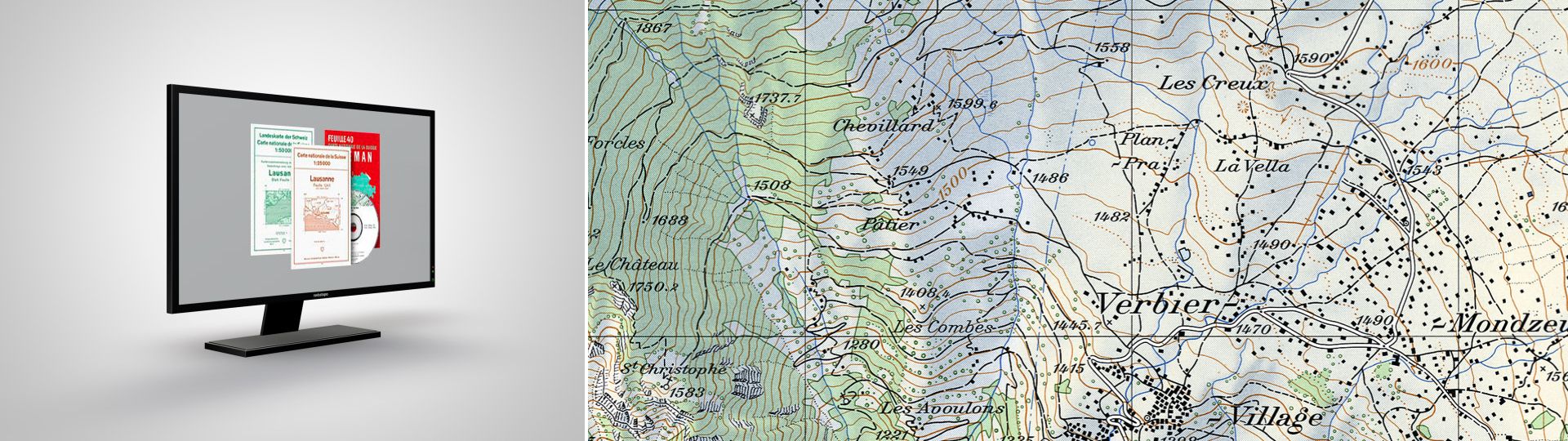
Digital Old National Maps
Already from about 1900, the first tests for new map series of Switzerland were carried out. The 1935 Federal Act named the new and still used National Maps as the official map series of Switzerland. They supersede the earlier Dufour and Siegfried Maps.
All editions are preserved in our Map Collection. The National Maps do completely cover the country in the largest as well as the smallest scales.
Official name: Swiss National Maps
Reference system: CH1903
Projection: Conformal oblique cylinder projection
Point of origin for height measurements: Repère Pierre du Niton 373,6 ASL = 'new horizon'
National Map 1:25'000
- Method of ground representation: contour lines 10 m (Alps 20 m)
- Method of reproduction: in the past negative scribing, today computer-assisted cartography
- Method of printing: offset printing
- Colours: 8
- Map format: 70 x 48 cm = 210 km2
- Number of sheets: 249
- First edition: 1952-1979
- Revision: continuously in a cycle of 6 years
Product specification
- File format: TIFF
- Georeferencing: TFW-File
- Resolution: 508 dpi (without relief shading), 254 dpi (with relief shading)
- Coordinate system: CH1903 (CH1903+ on demand)
- Delivery unit: entire map sheet without a frame
National Map 1:50'000
- Method of ground representation: contour lines 20 m
- Method of reproduction: in the past negative scribing, today computer-assisted cartography
- Method of printing: offset printing
- Colours: 6, now 8
- Map format: 70 x 48 cm = 840 km2
- Number of sheets: 78,5
- First edition: 1938-1963
- Revision: continuously in a cycle of 6 years
Product specification
- File format: TIFF
- Georeferencing: TFW-File
- Resolution: 508 dpi (without relief shading), 254 dpi (with relief shading)
- Coordinate system: CH1903 (CH1903+ on demand)
- Delivery unit: entire map sheet without a frame
National Map 1:100'000
- Method of ground representation: contour lines 50 m
- Method of reproduction: in the past negative scribing, today computer-assisted cartography
- Method of printing: offset printing
- Colours: 10
- Map format: 70 x 48 cm = 3360 km2
- Number of sheets: 22,5
- First edition: 1954-1965
- Revision: continuously in a cycle of 6 years
Product specification
- File format: TIFF
- Georeferencing: TFW-File
- Resolution: 254 dpi (with relief shading)
- Coordinate system: CH1903 (CH1903+ on demand)
- Delivery unit: entire map sheet without a frame
Price and ordering
The dataset is not available for free download. Please send your orders to geodata@swisstopo.ch who will make an offer for the costs of the provision of the data. To facilitate the order, please specify the area of interest (rectangle in Swiss coordinates, municipality, etc.), the format and, if necessary, the resolution or variant.
Additional information
Index
Federal Office of Topography swisstopo
Seftigenstrasse 264
3084 Wabern