
Images
Images of swisstopo are an instant view of the landscape, taken from the ground, airplanes or from satellites. These survey photographs allow for geometrically high precision processing.

Analogue or digital aerials images
Aerial photographs are views of the landscape, taken by airplanes with analogue or digital cameras.

Orthoimages
Images of swisstopo are an instant view of the landscape, taken from the ground, airplanes or from satellites. These survey photographs allow for geometrically high precision processing.
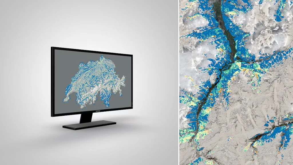
swissEO
swiss Earth Observation, is a set of products that provide area-based satellite products, indices and analysis-ready datasets with comprehensible algorithms in the field of drought warning.

Terrestrial images
Terrestrial images are views of the landscape, taken from the ground.
News about geodata
In this section you will find information about updates and news concerning swisstopo's geodata.
General information on obtaining geodata
Various options are available for downloading swisstopo geodata, depending on the data set. Large data sets are divided into spatial units for downloading. In the case of smaller data sets, the complete data content in its full geographical extent will be delivered. A user interface helps you select and download the geodata. An application programming interface (API) also enables you to obtain the data.

iFrame: Integrating the map viewer into a website
geo.admin.ch offers a simple and free way of integrating the map.geo.admin.ch map viewer into any web page using an iFrame.


Federal Office of Topography swisstopo
Seftigenstrasse 264
3084 Wabern