
Surveying procedures
Various surveying methods for collecting geodetic data are applied, depending on the specific task and desired degree of accuracy.

For the national survey, the cadastral survey and engineering surveys, points have to be measured and their coordinates have to be calculated.
For these purposes, various methods and procedures are used (see video).
This video is available only in German and French.

Trigonometric point determination
With trigonometric point determination the survey points are determined from the ground and calculated in accordance with the rules of trigonometry. These triangulation points – familiar metal pyramids at lookout points that serve as witnesses to the earliest national survey – are the result of this method.

Satellite-based surveying
Modern national surveying is based on signals from global navigation satellites.
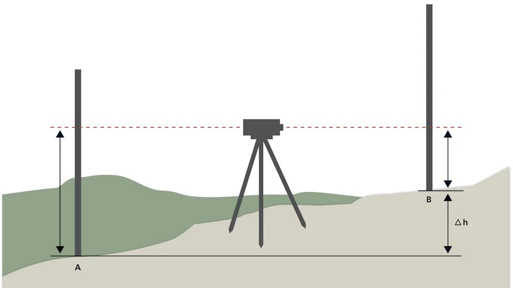
Levelling
Levelling is the classical and still valid method of determining heights.
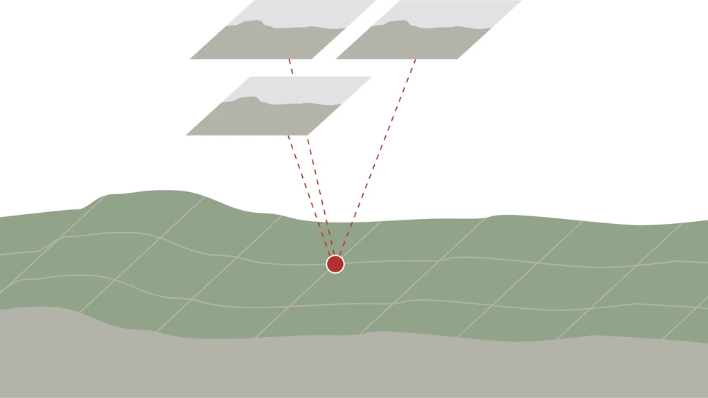
Photogrammetry
With photogrammetry, survey images and photographs are used for determining the spatial location or three-dimensional form of an object.

Laser scanning
Laser scanning refers to the linear or grid-based scanning of surfaces or objects with a laser beam in order to measure them, process them or produce an image.

Gravimetry
The Earth’s gravity field influences practically all geodetic measurements and thus always has to be taken into account. It is determined with the aid of gravimetric measurements.
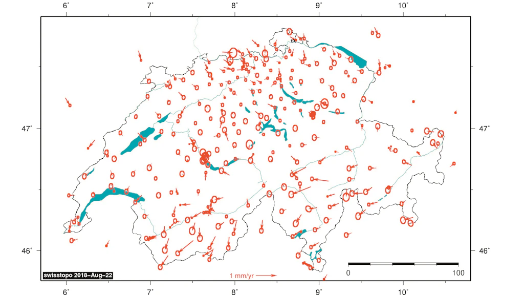
Re-measurements of control network
Every six years, swisstopo re-measures the national survey control network. Thanks to these measurements it is possible to obtain more precise information regarding Switzerland’s tectonic stability. Almost all geodata (i.e. data with a spatial context) that are used in Switzerland are based on one of the national survey control (fixed point) networks. It is therefore all the more important to periodically re-measure these networks. State-of-the-art satellite measurement technology is used for this purpose.
Federal Office of Topography swisstopo
Seftigenstrasse 264
3084 Wabern