
Find out more - Overview
Information about the geography and shape of Switzerland, as well as about people and facts associated with swisstopo.
List of articles
The economic value of the Confederation’s geological data
Construction projects are becoming more complex, whilst surface space is becoming scarcer. At the same time, demands on infrastructure, energy and spatial planning are increasing. Consequently, more and more projects are moving underground. To make well-informed decisions there, one thing is essential above all else: reliable geological information.
Geoinformation for well-informed decisions
For the Federal Department of Defence, Civil Protection and Sport, the security of Switzerland and its population have top priority. Thus security is also a daily concern of the Federal Office of Topography: swisstopo supplies precise geographical data that is available to the authorities and the general public. This solid information base is essential for responding to current needs.
New Utility Cadastre for Secure Supply and Waste Disposal Networks
Under the ground, there is a dense network of pipes and cables. Until now, there has been no harmonised national database of these: supply and waste disposal networks in Switzerland are not uniformly documented and the relevant information is accessible to varying degrees. This makes planning work more difficult and increases the risk of damage to underground infrastructure.
"The solidarity was overwhelming"
Flooding, landslides, villages cut off: the storms in the Maggia Valley at the end of June 2024 claimed seven lives and imposed huge challenges on the response teams. Eleonora Pedrini-Pedroli and Mattia Soldati from the crisis unit of the Canton of Ticino take a look back.
Switzerland’s Borders – More Than Just a Line on the Map
The national border appears immovable and defines the scope of application for laws and responsibilities. But natural forces or construction projects sometimes require that the border be adjusted. These changes are not arbitrary but are part of a diplomatic process that contributes to Switzerland’s stability.
CO₂ storage in the subsoil: a climate protection project
A future-oriented pilot project is on the agenda in Trüllikon, Canton of Zurich: the Swiss government, under the lead of ETH Zurich, is testing whether CO2 can be safely stored underground in the former Nagra borehole. The first tests are scheduled for next year.
“In Crisis Situations, Geoinformation is at the Heart of Decision-Making Processes.”
Michael Lanini has been Head of the Institute for Military Geography (MilGeo) at swisstopo since 1 November 2024.
Continuity of swisstopo’s geoservices: an ongoing challenge
swisstopo regularly maintains the availability of its geoservices at a level of over 99% by relying on high-capacity infrastructure and automatically backing up its data in decentralised data centres.
swisstopo helps geothermal energy make a breakthrough
Heat generation accounts for 50 percent of national energy consumption and causes over 35 percent of our CO² emissions. To ensure a sustainable supply of heat and reduce dependency on foreign gas and oil, Switzerland depends on sources such as geothermal energy – heat from inside the Earth.
Providing the means to Act Against Drought
Periods of drought are becoming more intense and more frequent in Switzerland. They deplete water resources, weaken ecosystems, increase the risk of forest fires, threaten agriculture, and hinder navigation. To counter these growing risks, the Federal Council has mandated the creation and operation of a national monitoring and alert platform that combines meteorological, hydrological, and satellite data.
Ensuring the Supply of Mineral Raw Materials
In Switzerland, the consumption of mineral raw materials amounts to approximately 55 million tons per year, which is 6.2 tons per capita. These raw materials are widely used, particularly in transport infrastructure and construction.
The history of the cadastral system: From Theodolite to Satellite Measurement
From the first cadastral maps in the 17th century to satellite measurement: Swiss surveying techniques have continually evolved over time. Today, they provide data with centimetre-level precision and will soon make it possible to create three-dimensional models.
The Swiss cadastral system – the invisible foundation of our land ownership
The Swiss cadastral system provides clarity: it protects land ownership, creates transparency and guarantees legal certainty – a one-of-a-kind model worldwide.
Safety policy is a joint responsibility
In view of the growing instability and threats worldwide, Switzerland has set up the State Secretariat for Security Policy SEPOS. An interview with its director, Markus Mäder.
.jpg?rect=0%2C750%2C1600%2C900&w=1024&auto=format)
«Having a woman in the team is enriching.»
Yogani Yogalingam is completing an apprenticeship at swisstopo as an information technologist with Federal Diploma of Vocational Education and Training Specialism System and Network Technology.
.jpg?rect=0%2C750%2C1600%2C900&w=1024&auto=format)
After obtaining a doctorate: entering the non-academic labour market
Camille Litty and Joan Sturm both chose to study for a doctorate. Today they are employed by swisstopo. They have returned to the business world after completing their high-level studies. Joint interview.

Data science applied to geodata
Methods for collecting, entering and analysing data with a spatial reference are evolving rapidly. However, it is not easy for public administrations to gain access to the results of research. As innovation project manager, Roxane Pott is head of the Swiss Territorial Data Lab (STDL) team. Together with her team she promotes a collaborative way of innovation.

Beyond the national borders
In November 2023, swisstopo opened its doors to the Vice Chairwoman of the National Boundary Commission at the Ministry of Foreign Affairs of Vietnam. Mrs Nguyen Thi Huong was accompanied by a delegation of specialists in border issues.

«Becoming a student again at the age of 40? My best career decision!»
After a professional reorientation, Monika Allemann now works as a specialist for information systems at swisstopo.

Preserving the legacy of Switzerland’s landscapes
During the past 175 years, swisstopo has been documenting Switzerland’s topographic development. Lea Dauwalder is well acquainted with the diversity of this historical heritage. She is responsible for the restoration and conservation of swisstopo’s map collection – a manual task that calls for a great deal of precision and attention to detail.

Focus on women
Women have been working in technical professions, geoinformatics and, namely, the field of geoinformation for a long time now. So we choose to turn our attention to the women in our federal office.
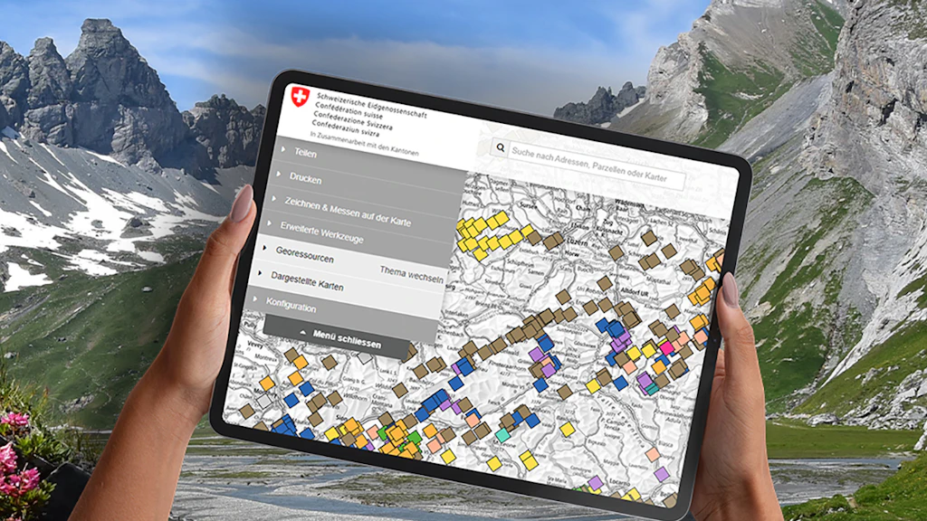
The topics ‹Geology› and ‹Geo-resources› get a new look!
The topic ‹Geology› has been given a new look and a new structure.
Wilderswil bypass
Our geodata are continuously being updated. The «Wilderswil bypass» project is now complete and the new routes are already visible on our online maps.
In search of data beneath the ground
What lies beneath the ground is still largely unknown – but it does provide a significant heat source. The Swiss Federal Office of Energy is supporting projects aimed at increasing the use of geothermal energy. At the same time, this is yielding geodata that is of great value for swisstopo.
Geodata to support digitalisation in the construction sector
The objective of the «building information modelling» method is to digitalise and network the construction sector. Geodata form a fundamental basis for this method. armasuisse Real Estate and swisstopo are implementing the project in an innovative way.
Paving the way towards a modern administration
With its digitalisation process and provision of geodata free of charge, swisstopo is paving the way towards new business models. These impulses are in line with the visions of «Digital Public Services Switzerland».
Shared mobility gaining momentum
If two or more people share the use of a vehicle, this reduces energy consumption. By coordinating data, the «sharedmobility.ch» project initiated by EnergieSchweiz simplifies car, bike and e-scooter sharing. swisstopo’s maps platform makes it easier for users to find available vehicles.
When the computer took over at swisstopo
«The future begins at every moment» is the title of an online exhibition at swisstopo, which illustrates the history of digitalisation and presents statements from «contemporary witnesses» who performed pioneering work.
Digital aid for hikers
Great news for outdoor enthusiasts: hiking suggestions from the Swiss Hiking Federation now include a QR code that takes you directly to the swisstopo app, which then becomes your smart guide.
Gubrist gets third tube
Our geodata are continuously being updated. The «Third tube of Gubrist Tunnel» project is now complete and the changes are already visible on our online maps.
The night sky over Zimmerwald
On a hill near Bern lies the Zimmerwald geostation. It is the fundamental point for the Swiss geographical survey. Here, specialists carry out research into the cosmos – and receive the occasional night-time visitor. It truly is an office with extraordinary views.
Photograms – an Ever-Growing Treasure
For over 100 years, swisstopo has been surveying Switzerland with the help of photographs. During the surveying work on the ground and from the air, new images of the landscape have continuously been produced in addition to measurement data. Originally, the images were mainly used to produce maps. However, over the decades, a historical treasure has been unintentionally created. Today, it opens up new doors for research.
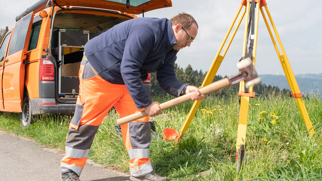
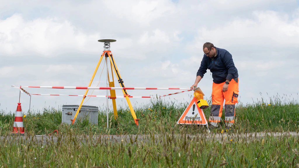
Hammering to millimetre precision
Surveying is millimetre precision work. In addition to good material and functioning infrastructure, relevant expertise is crucial. At swisstopo, nine people are regularly out on the roads surveying Switzerland. But what exactly do surveyors do and what does their everyday life look like?
The more, the better
The current network of geodetic points in Switzerland has been operated by swisstopo for 30 years. These points form the reference frame for all surveys carried out in the country. Repeatedly monitoring a point over several years shows whether and in which direction a region of Switzerland may be moving. The collected data simplifies the monitoring of natural hazards such as earthquakes or landslides.
mySwissMap is unique
With mySwissMap, swisstopo fulfils individual wishes. Anyone who orders a map chooses the area, the scale and the title. For outdoor lovers, there is now a new hiking map. mySwissMap makes a great gift as well.
Switzerland is moving
Coordinates are essential to define the location of a point. Because of Switzerland constantly moving, coordinates lose their accuracy over the years. swisstopo checks the changes every six years and thereby ensures that Swiss coordinates remain reliable. This enables, among other things, construction and maintenance of large infrastructure projects, such as the tracks for high-speed trains.
Good planning is half the survey
Many activities are second nature to people nowadays, such as sending your location to friends quickly and easily from your smart phone, letting your satnav get you from A to B or recording your morning jogging route on your smart watch. None of this would be possible if it weren’t for national surveying. Just two sequences of numbers, known as coordinates, are all it takes to locate any point in Switzerland. To ensure that the coordinates of a given point can be identified accurately also in the future Switzerland conducts new surveys every six years.
Depicting Switzerland’s terrain
In the past it had been carried out by hand, but today it’s done with the aid of software. IT specialist Roman Geisthövel focuses on depicting Switzerland’s terrain on maps. For this purpose he emulates manual cartographic presentation techniques.
Two specialists surveying the underground
Swisstopo geologists Eva Kurmann-Matzenauer and Salomè Signer are comprehensively studying the underground. They are developing 3-D models and thus creating solid bases for future utilisation of the realm beneath the surface.
Locating the country’s borders
Locating the country’s bordersAs the official responsible for surveying Switzerland’s national borders, Alain Wicht spends a great deal of time in the field, in addition to working in his office and in the diplomatic arena. His versatility provides him with some memorable moments in his daily professional life.
A step ahead of the future
Raphaël Rollier is implementing innovation processes at swisstopo and fostering digital transformation. He works together with universities, cantonal and other authorities in order to initiate future-oriented projects.
High capacity and flexibility thanks to cloud services
Cloud servers abroad ensure that the general public has access to geodata at any time. Hanspeter Christ is in charge of swisstopo’s cloud services. He has enabled swisstopo to play a pioneering role in the field of cloud computing.
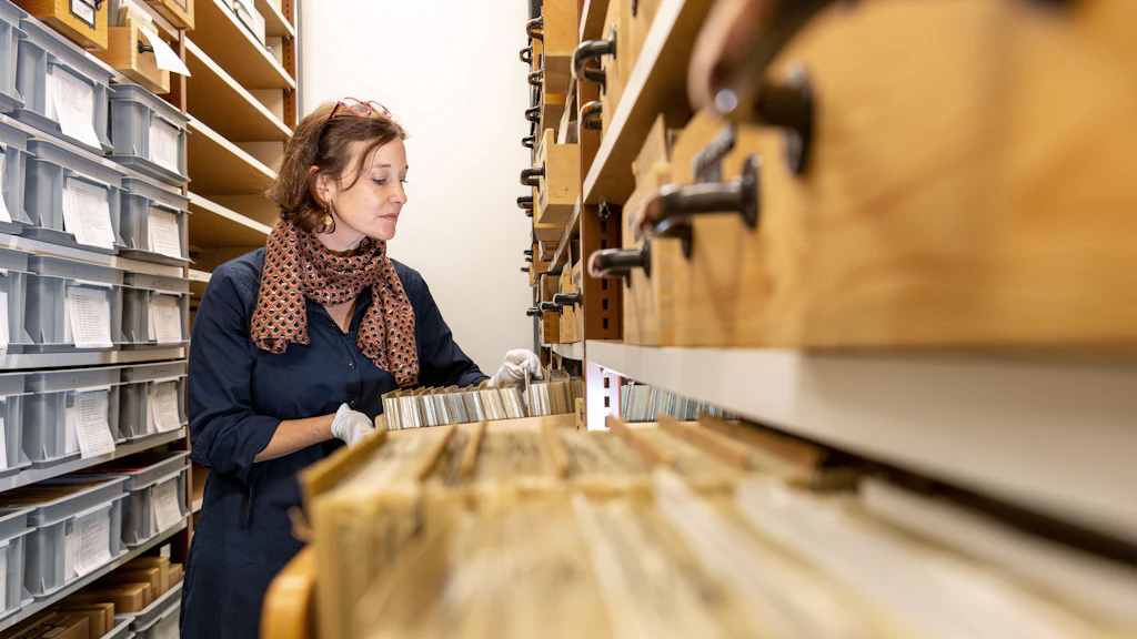
Treasures must be kept in safe hands
Nicole Jabrane and her team are breathing new life into the recorded history and development of Switzerland’s landscapes. As head of swisstopo’s image archives, her task is to ensure that valuable historical photos are preserved for future use.
An app as smart as swisstopo
It’s never been so easy to plan a walk or bike ride. The swisstopo app acts as your expert guide, surprising you in the process with its wide range of features. The ingenious product has scooped the Master of Swiss Apps award.
Long live the copper plates!
Swiss cartography has an excellent reputation around the world. It all began with 25 unique copper plates that were engraved by hand in the 19th century. They were used to record data for the first national map, and still impress as a cartographic medium today.
Extremely precise geodetic basis for the new CERN particle accelerator
The new particle accelerator at CERN requires precise geodetic bases from swisstopo.
Swisstopo geodata for glacial purposes
The GLAMOS Glacier Monitoring network observes the development of around 120 Swiss glaciers. Basic geodata from swisstopo in the form of aerial photographs, orthophotos, elevation models and vector data enable high quality content and facilitate research work.
Is the roof of my house suitable for a solar plant?
You can find the answer in just a few clicks at sonnendach.ch. The interactive website shows how suitable a property is for the production of solar energy. Building data from swisstopo forms the basis for calculating solar potential.
AGNES determines your position and the weather
The permanent measuring network, AGNES, can be used to determine positions with centimetre-level accuracy. But few people knew until now that AGNES is also used to produce weather forecasts.


Federal Office of Topography swisstopo
Seftigenstrasse 264
3084 Wabern